Reality capture in construction has moved through three eras. Laser scanners made it precise but rare. 360 cameras made it fast and affordable enough to run on every job, every week. The Visual Intelligence Platform now turns those images into insights builders can act on while a decision is still open.
OpenSpace customers have captured 77 billion square feet of site data across 132 countries, and the growth of that number shows how the shift happened.
What is reality capture & why does it have three eras?
Reality capture is the process of turning the physical world into data that teams can view, measure, and use to make decisions without standing on site. On Autodesk’s Digital Builder podcast, OpenSpace CEO Jeevan Kalanithi described its history in three chapters: laser scanners first, then cameras, then a move past capture toward intelligence.
Each era changed one thing about capture, and the clearest difference between them is the question a team could answer:
- Era one, laser scanning, made capture precise, so teams could ask what exactly was in place.
- Era two, 360 cameras and computer vision, made capture frequent enough to ask what the site looked like on any given date.
- Era three, Visual Intelligence, connects visual data to progress tracking, field workflows, and AI, so the question becomes what the team should do next.
Era one: the laser reality scan made capture precise but rare
For years, reality capture meant laser scanning. A tripod-mounted scanner collected millions of points from the built environment to build a point cloud with millimeter-level precision. That accuracy still makes laser scanning the right tool for as-built models, structural checks, and prefabrication where tolerances are tight.
The challenge was everything around the scan. Equipment pricing, trained operators, and processing time turned each reality scan into a project event, scheduled at key milestones. Between scans, teams went back to tape measures, scattered photos, and memory.
A lot of rework starts in those gaps. When the record covers only a handful of dates, a team can’t identify when a problem appeared or what the site looked like at that moment.
Where does laser scanning fit in reality capture today?
Laser scanning now forms one input to a broader reality capture platform. Kitchell, for example, uses OpenSpace 3D scans to take accurate measurements that map to the project plan and stay accessible to every stakeholder, which helps the team avoid opening walls and reduce rework.
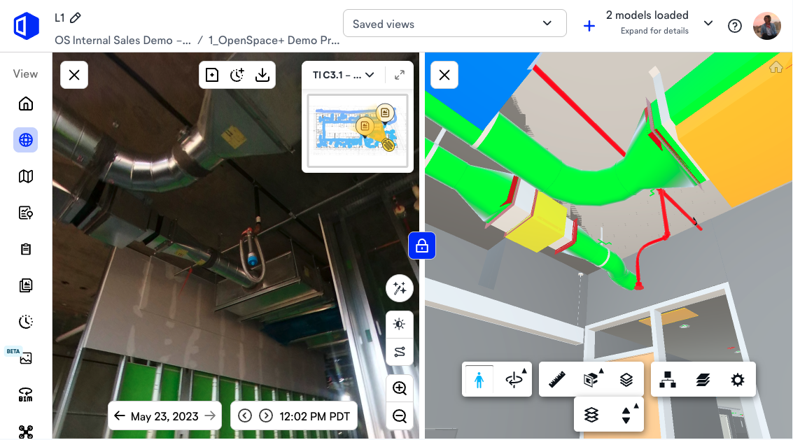
Polk Mechanical uses OpenSpace BIM+ to check field installations against the model. The company has tightened its quality control and reduced discrepancies between design intent and completed work.
Era two: how 360 cameras made site data frequent & affordable
Construction has long trailed other industries on productivity. The McKinsey Global Institute found that construction labor productivity grew about 1% a year over two decades, compared with 2.8% for the world economy. OpenSpace CTO Michael Fleischman has pointed to one reason: technology companies underserved construction for decades, so knowledge about the site lived in people’s heads and a few photos.
When OpenSpace started, 360 cameras were new to the market, and computer vision was good enough to digitize a job site for a fraction of what a laser scan costs. A camera collects less geometric detail than a scanner, but it is so much easier to use that capture moves from occasional to routine.
Ease of use decided adoption. Kalanithi has described how the founders spent their early days on live job sites with superintendents and project engineers, and “simplify everything” became the company’s first value. A tool that adds steps to a superintendent’s day gets dropped, so capture had to fit into the walk the team was already making.
How does a 360 reality capture walk work?
A team member walks the site with a 360 camera, and software maps the images to the floor plan:
- A superintendent or project engineer mounts a consumer 360 camera on a hard hat.
- They walk the site as usual while the camera records video.
- The software pulls images from the video and maps each one to the floor plan, creating a navigable record.
- Anyone on the team picks a location on the plan, chooses a date, and sees what was there.
The result works like street view for the job.
What frequent site data changed for builders
| Builder | Documented result |
| NOVO Construction | Moved from weekly documentation to nearly daily, with 95% less time spent capturing, uploading, and mapping images |
| Level 10 Construction | Documents its sites 5X faster than it did with other 360 tools |
| Lee Kennedy | Cut travel costs by 30% while producing 10X more complete documentation |
A located, dated image also settles disputes that a written report can’t. Kalanithi has made the point that describing what someone saw in words takes time and loses information along the way, and a photo pinned to the plan avoids that translation.
“The conversations changed first. On my family’s construction jobs, an argument about whether something got installed came down to whose memory you trusted more. When every walk leaves a dated record pinned to the plan, someone pulls up the location, picks the date, and the room moves on to what to do about it. Better documentation followed, because people walked the site knowing the record would actually get used.”
—Michaela Rhile, Product Manager, OpenSpace
How big is reality capture at construction scale today?
Reality capture now runs at construction scale: OpenSpace customers have captured 77 billion square feet across more than 95,000 projects in 132 countries. Public milestones show how quickly camera-based capture became standard practice:
| Date | Square feet captured | Countries |
| August 2019 | 150 million+ | Not reported |
| December 2020 | 3 billion+ | 33 |
| March 2022 | 7 billion+ | 75+ |
| October 2026 | 77 billion | 132 |
Sources: August 2019 partnership release, December 2020 milestone release, March 2022 Series D release, and openspace.ai for October 2026.
That is more than 500x growth in about seven years, and roughly 11x since March 2022. The country count quadrupled between 2020 and 2026.
Every walk adds images tied to a location and a date, and that volume of structured visual data is what trains computer vision models to recognize construction progress. Easier capture brings more teams onto the platform, and the data they collect makes the AI more useful for all of them.
The capture speed behind the growth
Adoption at this scale depends on capture fitting into a superintendent’s day. With 360 reality capture software like OpenSpace Capture:
- The camera records a 360 image roughly every half second during a walk.
- A team can document 25,000 square feet in about 10 minutes.
- Results are ready to review in about 15 minutes.
Large areas stay manageable because one walk covers the floor without stopping to set up a station.
Speed is crucial for a second reason: it decides whether data informs a decision at all. Kalanithi has said that results arriving days later are of little use to a builder, because by then the decision has been made. Fast processing keeps the record current enough to rely on in a meeting the same afternoon.
Era three: from capturing reality to Visual Intelligence
By the third era, collecting images was the easy part. Using them was harder, and capture-only solutions stopped at the record. An FMI study found that 95.5% of data captured in engineering and construction goes unused. The third era treats images as the starting point for analysis and action.
What a Visual Intelligence Platform does with site data
A Visual Intelligence Platform organizes images from a range of sources by location and date, compares them with drawings and BIM models, and pushes insights into the software and processes teams already use. In OpenSpace, that work happens in three places:
- Construction progress tracking software compares planned and actual work at the component level, with human verification so the output holds up in schedule and billing reviews.
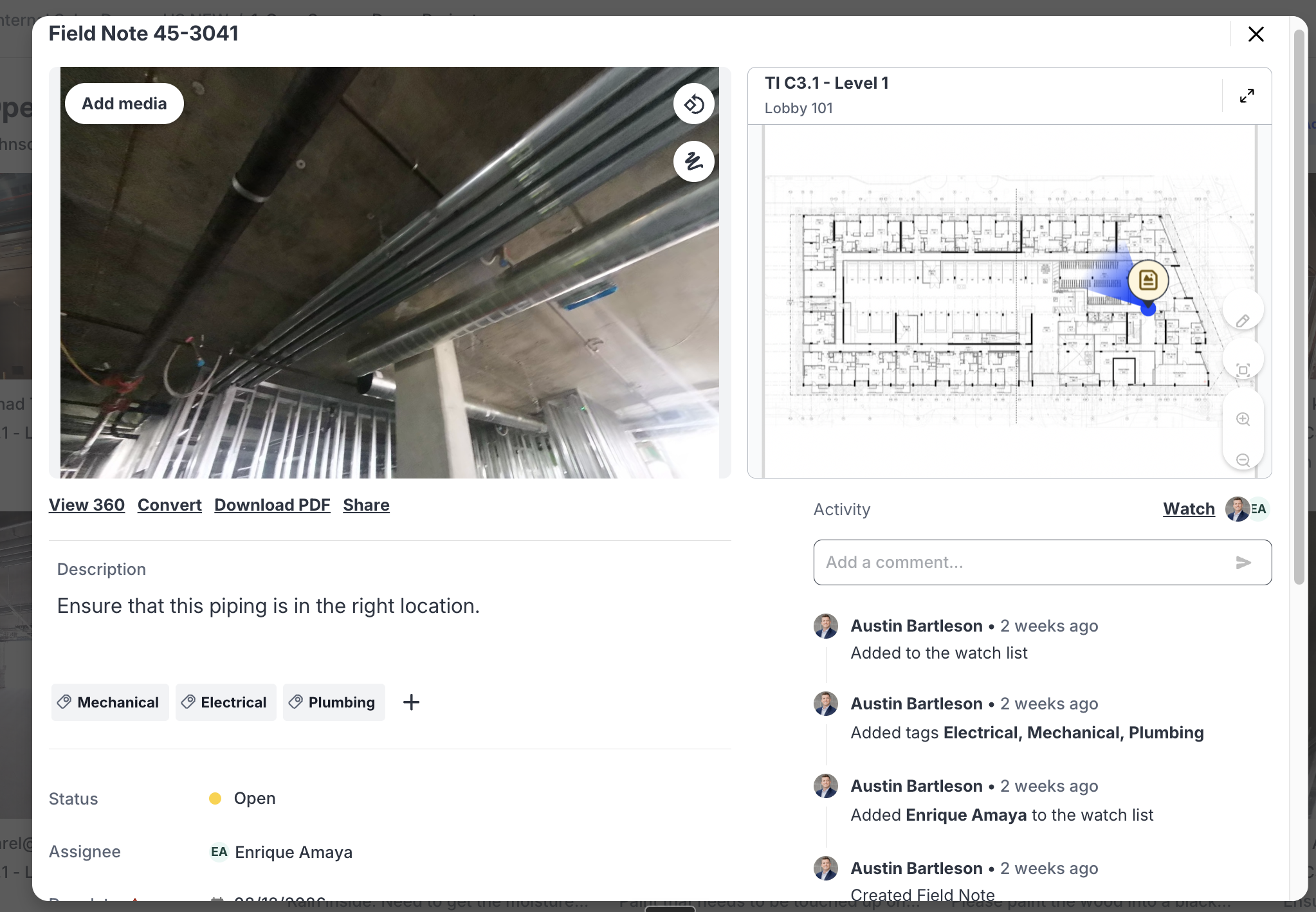
- OpenSpace Field lets foremen and superintendents log issues from their smartphones, pins each one to the plan, and integrates with Procore and Autodesk Construction Cloud through two-way sync.
- Search features in the Media Library, including AI Search, find specific photos across the whole project record.
The same record keeps digital twins accurate. A model meant to reflect the building needs a consistent stream of capture, or it drifts away from the truth on site.
Visual Intelligence results across global portfolios
Builders running OpenSpace across many sites report results like these:
| Builder | Scope | Documented result |
| Linxon | Piloted in Saudi Arabia, then rolled out across all active AMEA projects and extended to Europe and North America | Managers reported 10 to 15% less time on site, and planning tasks that once needed weekly calls now take minutes. HSE specialists review the same captures, which strengthened safety awareness across the portfolio |
| Global multi-site restaurant brand | Virtual store visits replaced in-person surveys across roughly 945 stores | Saved $230,000 on one project, enough to cover its OpenSpace investment |
“Builders can now make billing and schedule calls from the site record itself. Before I came to OpenSpace, I worked on the lending side of commercial real estate, where a draw request lives or dies on a percent-complete number someone has to defend. When progress is measured against the plan at the component level, and a person verifies what the AI flags, that number holds up with the owner and the lender. The team also sees a trade slipping while there’s still time to resequence the work.”
—Michaela Rhile, Product Manager, OpenSpace
How the three eras of reality capture compare
| Era one: laser scanning | Era two: 360 capture | Era three: Visual Intelligence | |
| Core technology | Terrestrial laser scanners | 360 cameras and computer vision | Spatial AI across smartphones, 360 cameras, and drones |
| Who captures | Trained specialists | Site teams during normal walks | The whole team, throughout the day |
| How often | Key milestones | Weekly or daily | Every walk, plus everyday photos |
| Main output | Point clouds and as-built models | A navigable visual record by date | Progress data, located issues, and AI-driven workflows |
| Best for | Millimeter tolerances, retrofits, and prefabrication | Progress documentation, disputes, and remote site reviews | Schedule, billing, and field decisions across a portfolio |
| Question it answers | What exactly is here? | What was here on any date? | What should the team do next? |
Find out where your team sits on this map. Talk to OpenSpace.
What comes after Visual Intelligence? Spatial AI & agents
The next step is software that knows where people are on site and acts on what it sees. Fleischman describes the goal as giving AI agents eyes. AI is only as reliable as the data it gets, and an agent working on a builder’s behalf needs to see the actual site.
AI Autolocation turns location into context
AI Autolocation gives software a user’s location on site. It works like GPS for the inside of a building, without satellites, beacons, or installed hardware, and estimates a user’s position on the floor plan from their smartphone.
Today it pins photos and issues to the right spot on the plan. The same capability can let an agent know which unit a superintendent is standing in and pull up the drawings and open issues for that location.
Why does general-purpose AI need organized site data?
General-purpose language models learned from internet text and images, not spatial data from job sites, so they need organized site data to make sense of a project. IBM describes this wider field as physical AI, meaning AI that works in and acts on the real world. Visual data organized by location and date gives these models context they lack today.
The system supports the team’s judgment: it flags issues, and people confirm them.
Consistent capture also gives builders a portfolio advantage. When every project is documented the same way, builders can compare jobs, ask why three buildings took longer than four others, and apply what they learn to the next project.
“The first thing I’d take off a superintendent’s plate is the hunt for information about the spot they’re standing in. They walk into a unit with a simple question and end up digging through the drawing set, the open issues list, and last week’s photos to answer it. That search repeats all day and adds nothing to the work. If the software already knows the location, it can put the current drawing, the open items, and the latest capture in front of them. The judgment calls stay with the superintendent, and the searching goes away.”
—Michaela Rhile, Product Manager, OpenSpace
Put reality capture to work across the project lifecycle
Laser scans still earn their place when tolerances are tight. For daily documentation, builders now expect the record to come from an ordinary walk, and the speed and quality gains come from what the team does with the images afterward. Teams that run reality capture in construction at scale today build a scalable record of every site and the visual data their AI tools will need next.
Request a demo of OpenSpace Capture and the Visual Intelligence Platform.
Frequently asked questions
How long does setup take on a new project?
Teams can expect to be up and running with OpenSpace Capture in about 15 minutes. It doesn’t take special skills, and the app works on any smartphone.
Does reality capture require a LiDAR-equipped smartphone?
No. OpenSpace uses LiDAR when a phone has it, but the system is built to work without it, and most customers’ phones don’t include LiDAR. Teams that need millimeter-level measurements can bring laser scan data into the platform instead.
Does 360 capture work on renovations and interior fit-outs?
Yes. Ground-level 360 capture works well indoors, where drones can’t fly and where many of a project’s toughest problems sit. OpenSpace Air then adds drone data for roofs, exteriors, and site-wide views.
Is capture data useful after construction is complete?
Yes. A dated visual record shows what sits behind finished walls and ceilings, so teams can check details like in-wall backing without opening anything up. Once walls close, that record is often the only view of what’s inside them.