For general contractors
Total clarity for confident decisions
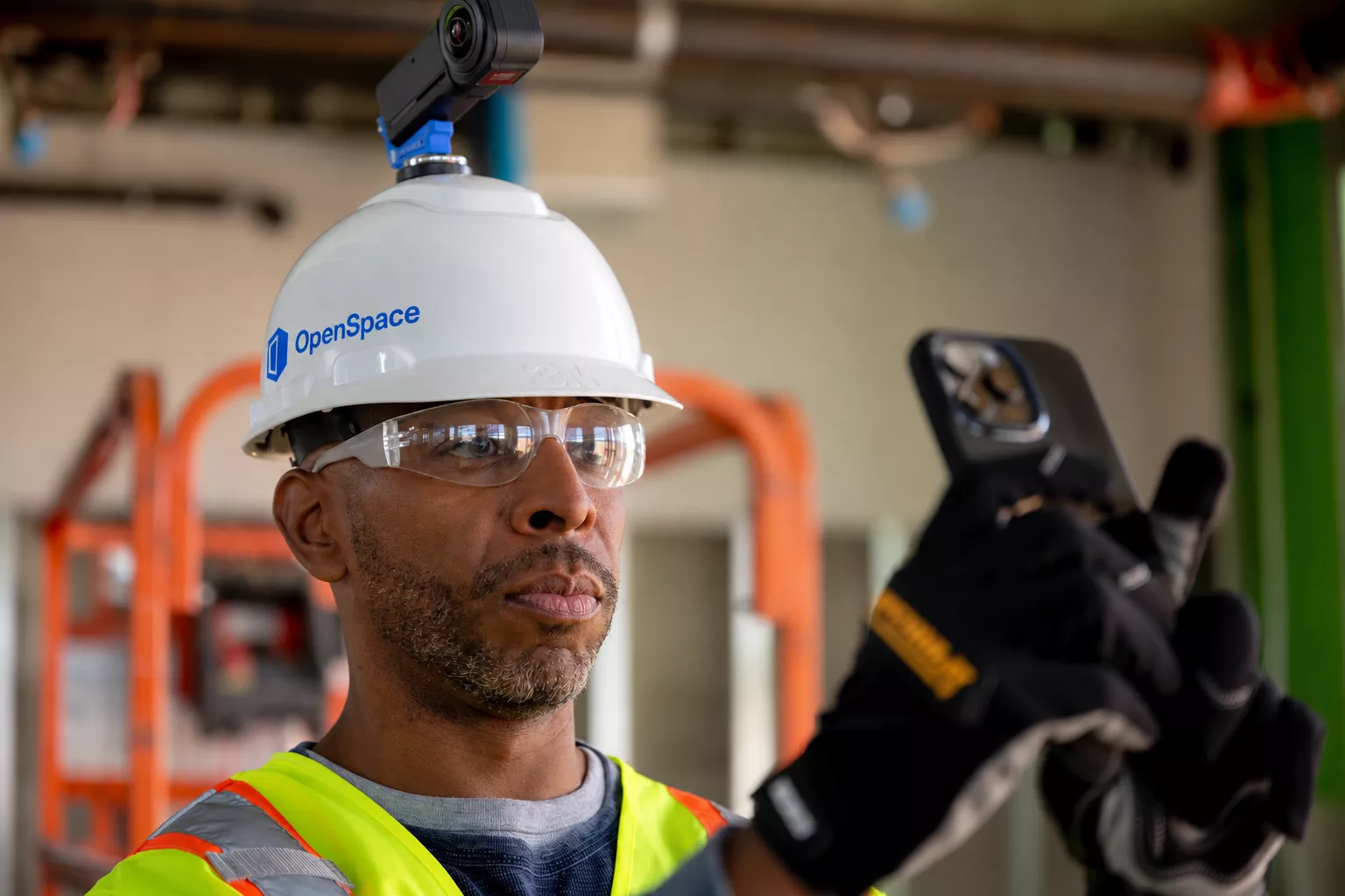
The Visual Intelligence Platform for general contractors. Capture what’s happening on-site. Turn images into intelligence. Make better decisions, faster.






One platform, every step of the job
Capture fast. Get back to building.
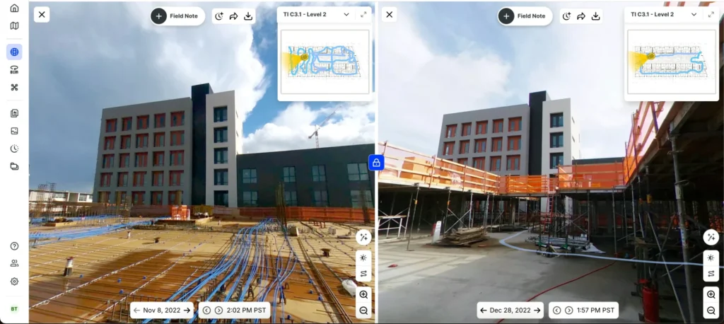
Connect your camera and walk. OpenSpace automatically time-stamps and maps every image to your plans for an up-to-date visual record of your project—no special skills required. Add in smartphone photos, drone imagery, and laser scans. All your imagery in one platform. One login. Simple to use.
Turn images into action
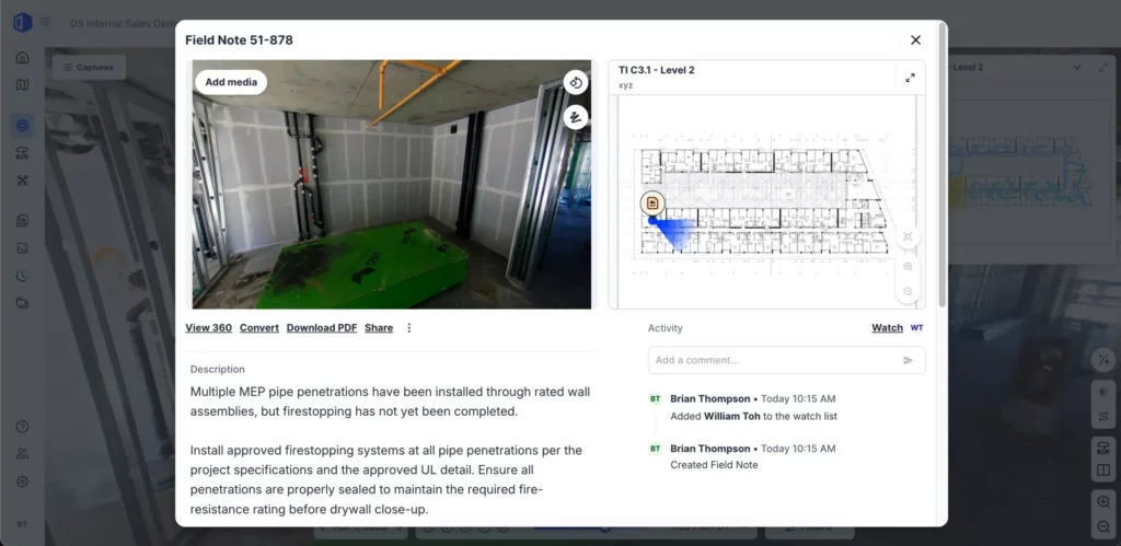
Turn what you see into what gets done with OpenSpace Field. Snap a photo to create a Field Note. Even send it to Procore as an Observation or Punch Item, or Autodesk as an Issue. Two-way sync keeps both systems aligned. AI Autolocation pins notes to the right spot on your plan—even indoors. Using BIM? Easily connect design intent to what’s built from the field.
See progress. Spot risk. Act earlier.
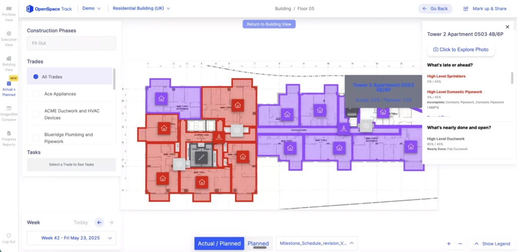
AI-powered, human verified progress tracking you can trust across trades, floors, and zones with OpenSpace Track. Catch risks sooner and make decisions based on what’s actually happening. Keep owners, executives, and field teams aligned with intuitive dashboards.

“OpenSpace is now built into how we run OAC and coordination meetings. Whenever there's a conflict or RFI, we go straight to OpenSpace for clarity... It's also strengthened our communication with owners... It's built trust because they can see the project evolving in real time.”
By the numbers
Real results from general contractors using OpenSpace:





All in one
Capture everything easily. See it in one place. Connected with the tools you use.
Fast—really fast
Document 25K sq. ft. in 10 minutes. View your 360° captures in 15 minutes, on average.
Deep integrations
Create Autodesk Issues and Procore Observations and Punch items once—mapped correctly and synced both ways—so your data stays up to date everywhere.
Reliable & accurate
AI-powered tracking with humans in the loop for unparalleled accuracy

OpenSpace works with the tools you already use
Your workflows work. OpenSpace makes them easier. Create Procore Observations or Punch Items, or Autodesk Issue right from OpenSpace with status, dates, location, and imagery synced both ways. Bring schedules from P6, Asta Powerproject, Microsoft Project, or Excel into OpenSpace Track with seamless integrations. APIs and single sign-on keep everything else connected.




Support & learning. On your time.

OpenSpace academy
Free, on-demand courses with easy-to-follow instructions, tips, and tricks.

Support
Our 360° approach to support: 24×6 support lines plus online support for advice and answers.

ROI
Resources for evaluating how OpenSpace can help you build faster and with less risk.
Frequently asked questions
What is OpenSpace?
- OpenSpace is the Visual Intelligence Platform for builders. We help general contractors make better decisions, faster, based on reality, not opinions or siloed documents.
- Capture your sites with smartphones, 360° cameras, and drones. Our Spatial AI engine turns that imagery into intelligence by anchoring it to time, place, and your plans and a model (if applicable).
- One platform, five products that work together across the project lifecycle:
- OpenSpace Capture: the foundational visual record of your project
- OpenSpace Air: drone imagery management
- OpenSpace Field: image-first task management with AI Autolocation
- OpenSpace BIM+: 3D model navigation for the field
- OpenSpace Track: reliable progress tracking grounded in reality data
- Used on 110,000+ projects across 132 countries, with 77 billion+ sq ft of structured visual data on the platform.
What is the difference between OpenSpace and other reality capture tools?
- Most tools document. OpenSpace helps you act. Reality capture is becoming table stakes; what happens after capture is the real difference.
- Image-first workflows: tap once from a photo to create a Procore Observation, Procore Punch item, or Autodesk Issue. No double entry, no manual pinning.
- Spatial AI: imagery is automatically located in space and time and connected to your plans, models, and workflows. Captured by anyone, useful to everyone.
- Field-first by design. Built around how superintendents, PMs, and crews actually work.
- The largest visual intelligence foundation in construction (77 billion+ sq ft and growing), which is what powers our AI advantage.
How quickly can I start capturing? How fast is your processing speed?
- Project setup takes 5 to 10 minutes. Upload your plans, mark your starting point, and capture.
- Capture however fits the job: 360° camera on a hard hat, smartphone with AI Autolocation in OpenSpace Field, or drone via OpenSpace Air.
- Images are ready to view in ~15 minutes on average, automatically aligned to your BIM model and plans.
- Smartphone, 360°, and drone imagery all flow into the same platform, so you skip tool-switching and reconciliation.
How easy is it to roll out OpenSpace at scale and gain adoption?
- Built for the field from day one. Capturing adds little to no extra work to a normal walk, so adoption sticks.
- Works on Android and iOS. Integrates with the tools your teams already use (Procore, Autodesk, Revizto, P6).
- Free, on-demand training via OpenSpace Academy and 24×6 support to keep teams moving.
- The most widely adopted 360° capture platform in construction. Functionality only matters if teams actually use it.
- Suffolk Construction scaled OpenSpace from a single project to roughly half of all projects.
Does OpenSpace work with drones?
- Yes. OpenSpace Air imports drone-captured imagery and transforms it into point clouds, 3D meshes, and orthomosaics, all inside the same platform you already use for interior captures.
- Compatible with DJI, Skydio, and Esri-supported drones. No separate platform, no specialist service to interpret the data.
- Use Air for site logistics, earthworks, cut/fill analysis, and exterior progress alongside your 360° interior walks for full-site visibility from preconstruction through closeout.
Does OpenSpace use AI? What about AI agents?
- Yes. OpenSpace has been AI-powered since day one. Our Spatial AI engine is what makes Visual Intelligence possible: it locates every image in space and time, understands what’s in it, and connects it to plans, models, and workflows.
- Newer AI capabilities include AI Autolocation in OpenSpace Field (real-time indoor positioning without beacons or special hardware) and AI Voice Notes (spoken field context turned into structured, searchable insights).
- On AI agents: agents are coming to construction, and they need eyes. The structured visual data on OpenSpace is exactly the foundation agents require to operate on a jobsite. We’re working with a small group of builder partners through an Early Access program on agent use cases like issue review, safety, and site search.
- To go deeper, see our CEO and CTO posts on Visual Intelligence and “agents with eyes” on the OpenSpace blog.
Do big companies work with OpenSpace?
- Yes. OpenSpace scales from single renovations to multi-year megaprojects, and from one jobsite to global portfolios.
- 110,000+ projects across 132 countries. Customers include Suffolk, Balfour Beatty, Kitchell, Lee Kennedy, Level 10, NIBBI, and Tishman Speyer.
- Enterprise-ready: SOC 2, Cyber Essentials, SSO, and regional data residency across the US, EU, UK, AU, CA, JP, KSA, and SG.
- Backed by blue-chip investors with nearly $200M raised to date.
What other software does OpenSpace integrate with?
- Deep two-way integrations with Procore (Observations, Punch) and Autodesk (Issues).
- Tap once from imagery in OpenSpace Field to create issues directly in your system of record, mapped to your existing templates and fields.
- Also integrates with Revizto and scheduling tools (P6, Asta, Microsoft Project, Excel) through OpenSpace Track for progress and schedule data.
- Images API, Field Notes API, and Usage API for custom workflows and BI reporting.
- SSO across the suite.