
BIM coordination, built for the field

OpenSpace BIM+
User-friendly 3D tools that bring BIM coordination to the field—no BIM expertise needed.

Answers on-site fast
Answer BIM questions on-site. No specialized training. No new hardware needed.
Update in minutes
Updating site imagery and models is fast—so you always have the latest information.
See & solve
See your model side by side with what’s built. Make decisions with clarity.
Coordinate with clarity
BIM capabilities combined with a fully captured site—enhancing coordination, helping teams work like teams.
BIM analysis made easy
Get clarity from your model and 360° images. Easy to navigate. Easy analysis. No more guesswork.
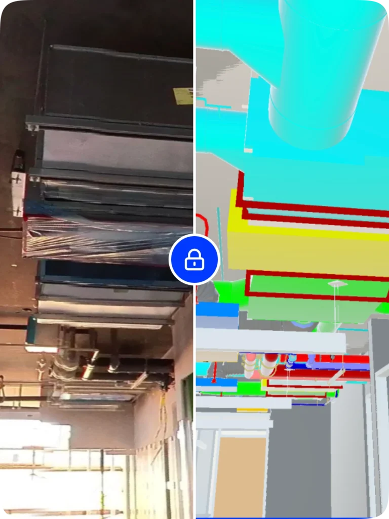
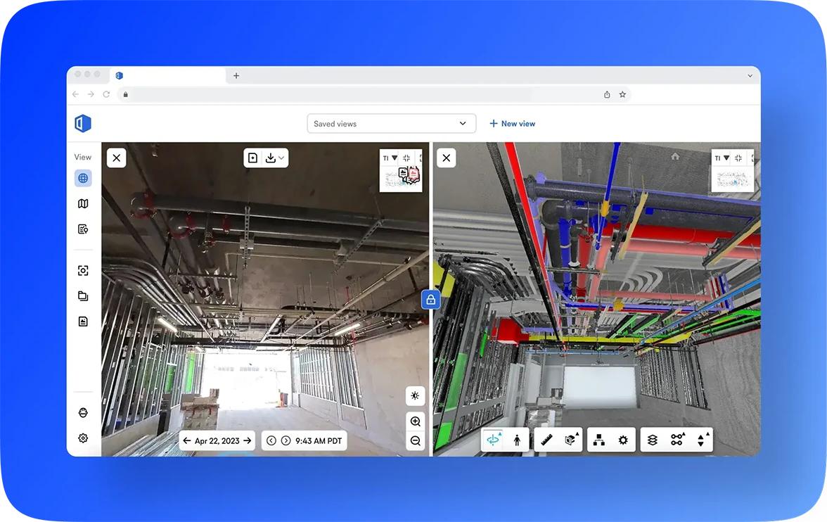
BIM Compare
View your model and 360 images side by side: spot discrepancies, snap measurements, toggle layers, and plan what’s next.
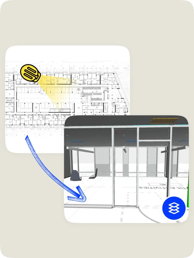
Sheet Overlay
Layer 2D sheet drawings (including annotations) on the floor of the model—quickly reference surrounding rooms and understand where you’re standing in the project.
Let images & models do the talking
Visual Intelligence connects site imagery and BIM for clear communication, right away.
Saved Views
Bookmark common BIM views (e.g., first floor bathroom-no ceiling or slabs hidden) so anyone can jump in and get oriented fast—no model wrangling needed.
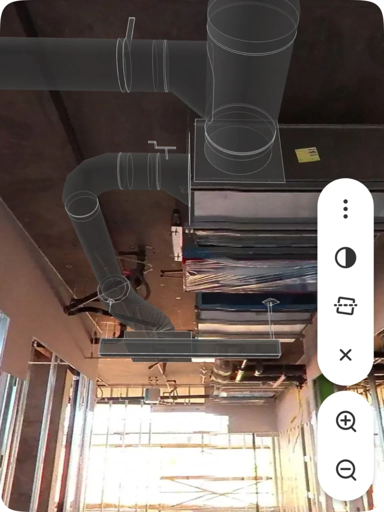
BIM Element Overlay
Drop model elements, like HVAC grille, into your site imagery for better spatial planning and coordination. No need to switch between multiple platforms.
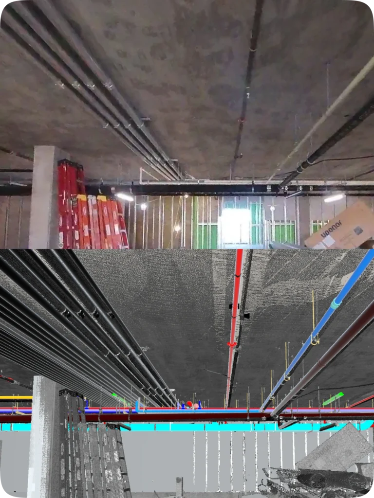
Point clouds in BIM Compare
Compare laser scan point clouds to your model to spot clashes and solve coordination problems right from the field—saving a call to a BIM specialist.
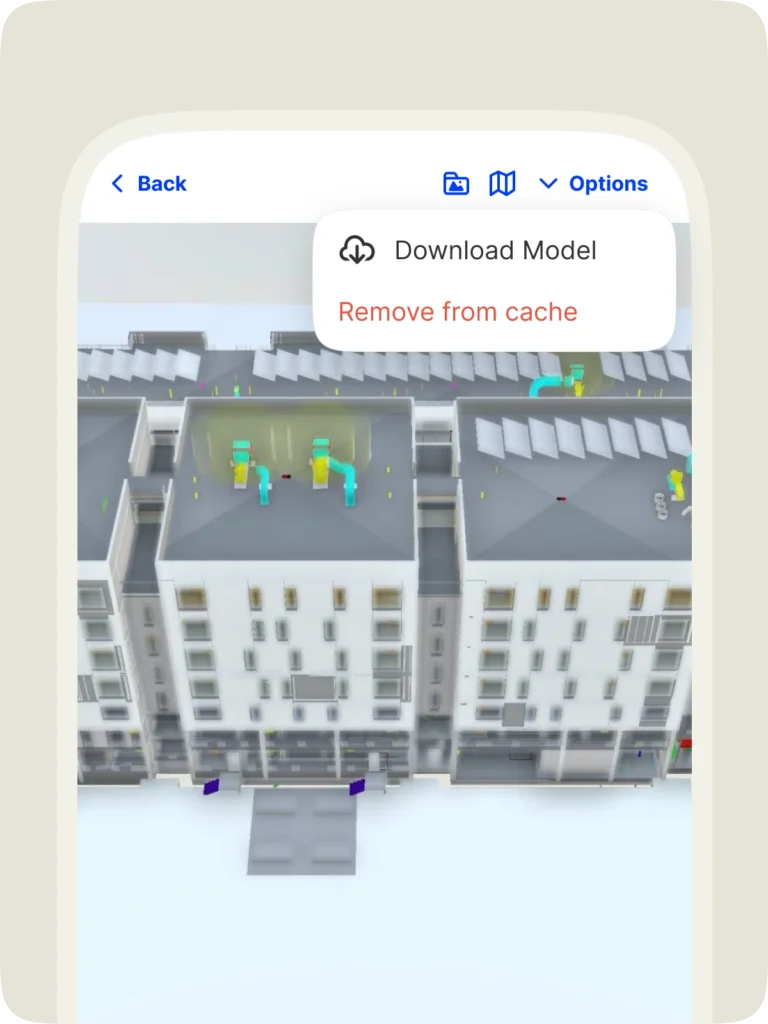
BIM offline for mobile
No signal? No problem. Download models in the app and view them on your smartphone, anytime, anywhere.
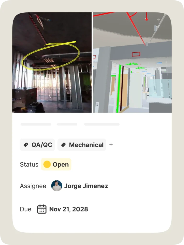
BIM Compare Field Notes
Call out discrepancies between BIM and what’s built—with the image and model in a single view. Mark up, tag, add assignees, and more. Resolve issues quickly and visually.
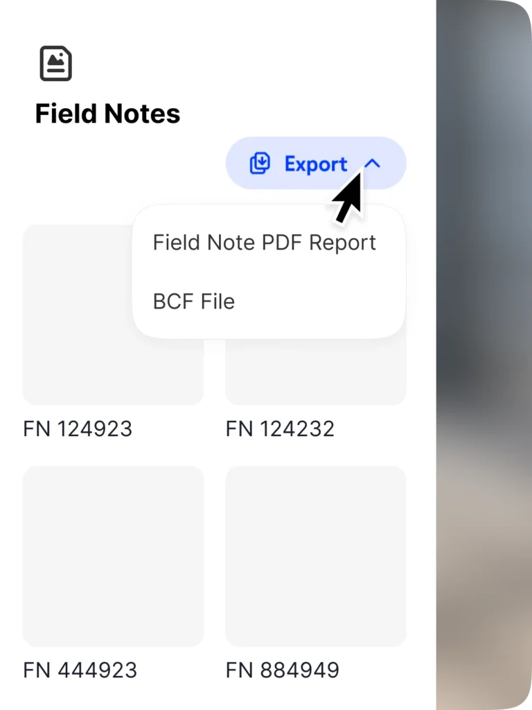
BCF export
Streamline workflows with access to your Field Notes—including associated data and 3D coordinates—in your BIM program. Just export your notes and import into a BCF-compatible tool.
View models the way you want
Stay current with up-to-date models straight from the source. Multiple model support delivers faster loading and smoother coordination.
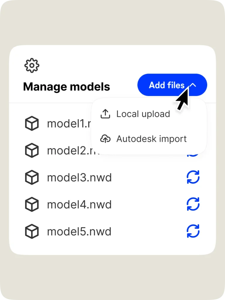
Autodesk model import
Import models directly from Autodesk or BIM 360. No manual downloads or uploads. Just done.
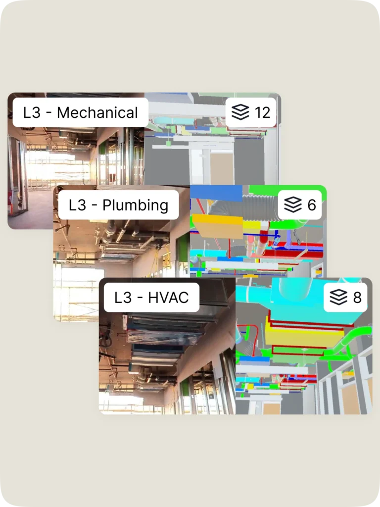
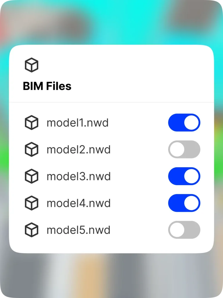
Multiple models
Link multiple models to a project. Choose the one you want to view. Even split models by floor or scope for faster load times and better focus.
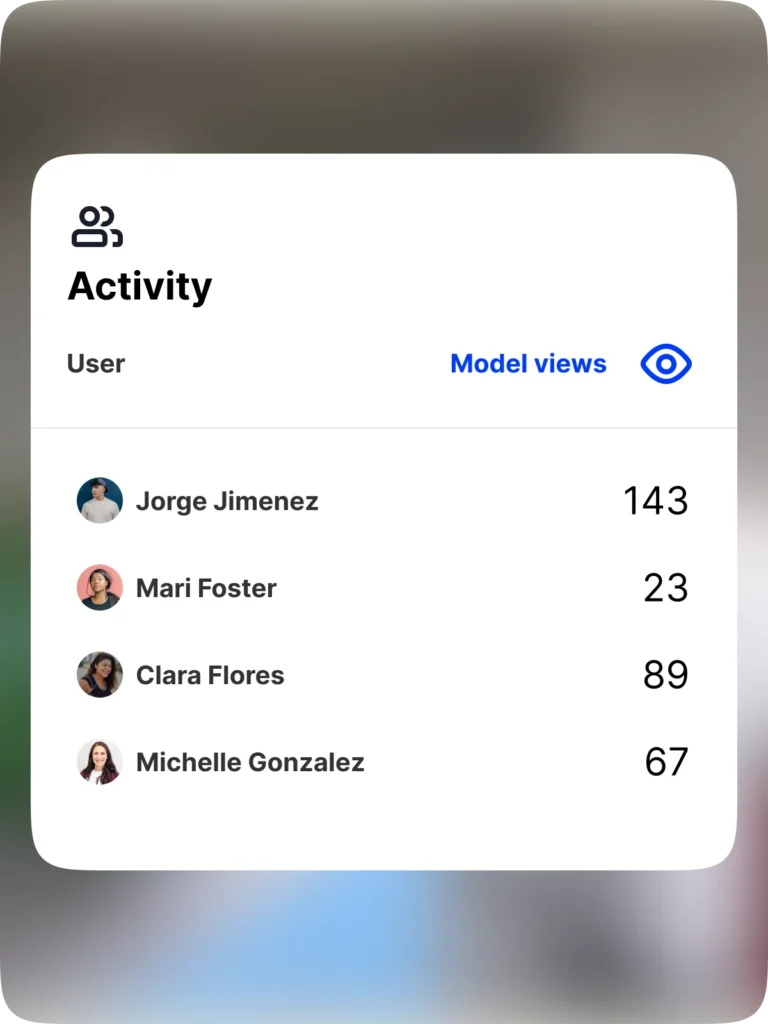
Model view count
See who’s viewing what model and how often, making it simple to measure ROI for BIM.

“With OpenSpace BIM+, our project teams can answer questions in minutes from the field, reducing the back-and-forth they experience when resolving everyday issues.”

Support & learning. On your time.

OpenSpace academy
Free, on-demand courses with easy-to-follow instructions, tips, and tricks.

Support
Our 360° approach to support: 24×6 support lines plus online support for advice and answers.

ROI
Resources for evaluating how OpenSpace can help you build faster and with less risk.

Frequently asked questions
What is OpenSpace BIM+?
OpenSpace BIM+ is a package of easy-to-use 3D tools that helps you get work done faster by unlocking BIM coordination between the office and the field. If you’d like to get started using OpenSpace BIM+, request a demo.
How is OpenSpace BIM+ different than OpenSpace Capture?
OpenSpace BIM+ is an add-on module that expands on our BIM Compare feature. The additional BIM capabilities included in OpenSpace BIM+ make it even easier to navigate, analyze, and manage your BIM models by leveraging the image and location data of OpenSpace Capture.
Do you need OpenSpace Capture to use OpenSpace BIM+?
Yes, the images and functionality of OpenSpace Capture are the foundation for OpenSpace BIM+. You cannot use OpenSpace BIM+ without OpenSpace Capture.
Do you need a model to use OpenSpace BIM+?
Yes, OpenSpace BIM+ furthers your BIM investment by making your models available to all project team members including field teams.
Is OpenSpace BIM+ available now?
Yes, OpenSpace BIM+ is available to everyone. Interested in getting started? Request a demo.
Where can I find more information?