
Contractors fly drones over the entire site on a fixed schedule, turn each flight into maps and 3D models, and compare the results with the last flight and the plans to see what got built and what’s behind. With drones, construction progress tracking covers sitework and structure in a single pass, so nobody has to walk every acre to report on it.
The catch comes at dry-in. Once the building closes in, aerial imagery has little left to show, and teams need ground-level 360° capture to carry the progress record forward on the same plan and timeline.
Across the construction industry, drone technology is now a routine part of project management on large sites. Project teams get real value from it when they treat drone flights as one layer of a visual record that continues indoors.
What does drone construction progress tracking measure on a construction site?
Drone construction progress tracking measures how the construction site changed between flights, such as earth moved or steel erected. Mapping software stitches overlapping drone images into several outputs, and each one answers a different progress question.
Two people walking the same site can report different percentages, while two aligned flights show the same change to everyone who opens them.
| Output | What it is | Progress question it answers |
| Orthomosaic | One corrected, measurable map built from overlapping aerial images | What does the whole site look like today, and what changed since the last flight? |
| Elevation model | A surface map showing height across the site | Is grading on plan, and where will water flow? |
| Point cloud | Millions of measured points in 3D space | Do built conditions match the design in position and height? |
| 3D mesh | A textured 3D model of the site | Can stakeholders who aren’t physically present understand site conditions? |
| Volume measurement | Cut, fill, and net volume between two surfaces | How much material moved, and do earthwork calculations match the plan? |
In a peer-reviewed study published in Sensors, a team compared drone-derived point clouds with programmed progress in a 4D BIM environment on a reinforced concrete residential building. They concluded the method worked for tracking progress and for showing stakeholders the completed construction work.
How do drone flights turn into a construction progress record?
Drone flights become a construction progress record when pilots fly the same plan each time and each output lines up with the one before it. For aerial capture, the construction process runs in five steps:
- Fly a repeatable mission. Drone pilots fly the same path, altitude, and overlap on every visit, so the aerial images cover identical ground.
- Upload and process. The team uploads the photos, and OpenSpace Air processes the drone imagery into orthomosaics, elevation models, point clouds, and meshes.
- Align flights. Virtual control points lock orthomosaics from different flights to the same location, which keeps measurements accurate without expensive survey equipment.
- Overlay the plan. Project engineers lay site plans and utility drawings over the orthomosaic to find where work departs from the design.
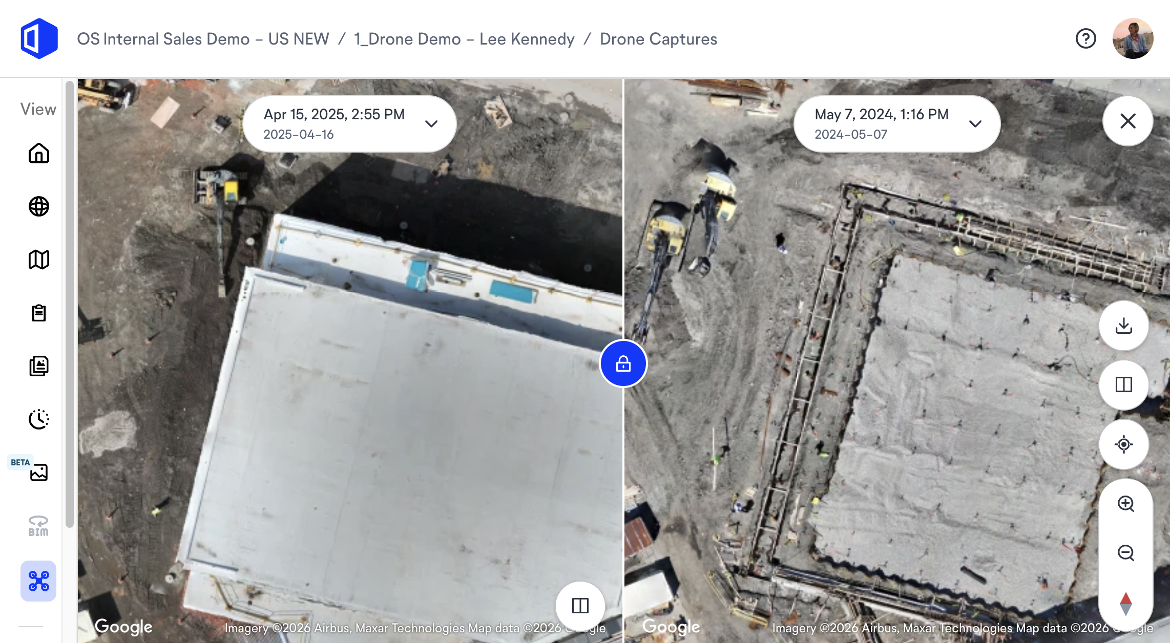
- Compare and share. Split View puts up to four orthomosaics side by side, and volume measurements between any two flights show how much material was added or removed.
Project managers end up with a visual timeline they can use to monitor progress and keep stakeholders informed between site walks.
“After years of building drone mapping software, I can usually trace a misleading comparison back to the flight itself. A pilot changes the altitude, cuts the overlap to beat the wind, or skips alignment, and two maps that should match drift apart just enough to look like progress. The teams that get it right lock the mission, altitude, and control method before the first flight. They treat any change to those like a change order.”
—Jess Lam, Product Manager, OpenSpace
What should be settled before the first drone flight?
Before the first flight, decide who flies, how often, how flights line up, who gets updates, and where files live:
- Who flies. In the U.S., commercial drone operations fall under the FAA’s Part 107 rules, which require the pilot to hold a remote pilot certificate with a small UAS rating or fly under the direct supervision of someone who does. Decide whether an in-house pilot or a contractor runs the construction drone program.
- How often. Match flight frequency to the schedule, with more flights during mass earthwork and structure and fewer once exterior work winds down.
- How flights line up. Lock the flight plan and control method at the start so every new orthomosaic compares against the last one.
- Who gets updates. Name the people who need regular progress updates so they can track progress.
- Where files live. Store aerial data with the rest of your site data and ground capture so the visual timeline carries through dry-in.
Are drone surveys a cost-effective alternative to traditional methods?
Drone surveys are cost-effective for frequent, site-wide progress snapshots, since one flight can document large sites that take hours to walk. Work that calls for survey-grade accuracy, such as certifying final elevations, still belongs to a licensed surveyor using traditional methods. Between survey visits, drone mapping fills in with orthomosaic mapping and other useful data.
Where does aerial construction progress tracking pay off on construction projects?
Aerial construction progress tracking earns its keep early in construction projects, while most of the work sits on open ground. Its usefulness drops once crews move under a roof. Here’s what regular flights capture at each stage, where the aerial view goes blind, and what covers the gap.
| Phase | What drone capture shows | Where the aerial view goes blind | What fills the gap |
| Sitework and earthwork | Grading, cut and fill, stockpiles, haul roads, open utility trenches | Utilities once trenches are backfilled | Aerial and ground capture before backfill |
| Foundations and structure | Footprint, pours, steel and deck progress, crane and laydown logistics | Lower levels once decks stack above them | 360° walks floor by floor |
| Envelope and roof | Roofing, facade panels, rooftop equipment | The interior side of every wall | 360° capture plus close-up drone images of facades |
| Interiors | Roof condition and site logistics only | Framing, MEP rough-in, drywall, finishes | 360° capture tied to schedule tasks |
| Closeout | Paving, landscaping, final site condition for the owner | Concealed MEP and in-wall work | The ground-level visual records captured earlier |
Drone capture also helps with a broad range of work across a project’s lifecycle, from topographic surveys in preconstruction to quality control on facades. A flight over an open excavation or a roof also spares someone the safety risks of checking it on foot.
See how OpenSpace Air turns drone flights into site-wide progress views. Request a demo.
Drones, construction progress tracking & the dry-in handoff
The dry-in handoff is the point where a drone construction progress update no longer gives the full picture. After the envelope closes, most of the work progress that affects schedule and billing happens where aerial images can’t reach, so ground capture takes over.
Why do progress records break at dry-in?
Aerial construction progress tracking can’t see behind the envelope, and this is where many progress records fall apart. With the aerial record in one system and interior photos in another, someone ends up stitching the story together in written reports—the job visual records were supposed to take over.
How should teams plan the aerial-to-ground handoff?
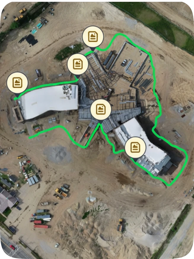
Teams avoid the break by planning the handoff before the first flight. In OpenSpace Air, a drone orthomosaic can serve as the base sheet for 360° captures from day one, which ties every ground capture to current site conditions before drawings even exist. When crews move indoors, the aerial and interior visual data stay in the same project, sorted by location and date.
How Suffolk & Gilbane connect aerial and ground capture
Suffolk works this way across its portfolio. Its published case study lists OpenSpace Air as one of four capabilities in its site intelligence program, with aerial imagery kept alongside ground capture and progress tracking. Adam Fyrer, Senior Associate, Construction Technology at Suffolk, put it this way:
“OpenSpace Air gives us a true bird’s-eye view of the entire site. Instead of piecing together progress from multiple sources, we can see everything at once—foundations, superstructure, logistics, materials—and even overlay our models to verify what’s been installed. It allows us to make faster, more informed decisions and communicate progress clearly to our teams and clients.”
Gilbane reports something similar. Project Executive Scott Wyatt has said that with drone imagery in OpenSpace, his team can show conditions outside the building’s four walls that they couldn’t see before and catch project items earlier.
“Aerial capture carries most of the progress story through sitework, structure, and the envelope. Once the building is dried in, the drone can still show you the roof and the laydown yard, and that’s about it. The mistake I see is running the drone program and interior capture as two separate efforts. If the orthomosaic isn’t the base your ground captures sit on, you lose the thread right when the schedule gets most crowded.”
—Jess Lam, Product Manager, OpenSpace
How do you connect drone data to construction progress monitoring?
You connect drone data to construction progress monitoring by pairing aerial evidence of change with task-level tracking tied to the schedule. A flight can show that a slab was poured, but a schedule update also needs to know which tasks that pour closes out and how far along each trade is. For many teams flying drones, construction progress tracking stops at the aerial view, which leaves schedule status to guesswork.
Indoors, OpenSpace Track handles that part. Here’s how the two capture layers split the work:
| Drone capture with OpenSpace Air | 360° capture with OpenSpace Track | |
| Best coverage | Sitework, structure, envelope, roof | Interiors, from framing through finishes |
| What it tells you | What changed across the site between flights | Percent complete by trade against schedule tasks |
| Key outputs | Orthomosaics, elevation models, point clouds, volumes | Planned vs. actual progress across 700+ visual components and 200+ schedule tasks |
| Schedule connection | Visual comparison against plans and drawings | Integrates with P6, Asta Powerproject, Microsoft Project, and Excel |
OpenSpace Track pairs AI analysis with expert human review, so reports hold up in schedule and billing conversations.
When evaluating construction progress tracking software, check where the aerial record lives. In OpenSpace, both records sit in the same Visual Intelligence Platform, so owners and trades stay on the same page. The full guide to construction progress monitoring goes deeper on capture cadence and verification.
Who else uses aerial progress records?
Owners, lenders, and project controls teams all use aerial progress records, each for a different decision. Owners and their reps use regular flights to follow a job they can’t visit every week. On financed projects, lender inspectors review progress before releasing draw payments, and a dated aerial record gives everyone the same reference point.
When a disagreement comes up over what was in place and when, time-stamped aerial images help teams reduce construction disputes because the record doesn’t depend on anyone’s memory.
“Owners look at an aerial update and ask, “So are we on schedule?” The map can show them the steel is topped out or the parking lot is paved. It can’t show whether the fourth floor is ready for drywall. That answer takes someone capturing the inside, tying it to the schedule, and putting both views in front of the owner in one place.”
—Jess Lam, Product Manager, OpenSpace
Connect aerial and ground progress in one visual record. Talk to an OpenSpace expert.
Plan the handoff before the first flight
For teams adopting drones, construction progress tracking starts with a fast, repeatable view of the entire site. Two key benefits—earthwork calculations and aerial views owners can read at a glance—start paying off on day one and speed up decision-making for all the teams involved.
Aerial construction progress tracking holds its value through closeout only when aerial and ground capture share one plan and one timeline, so set that up on every job site before the first flight. To see how both work together, explore the drone mapping software for construction built into OpenSpace.
Always visible. Never in doubt. Request a demo of OpenSpace Air and OpenSpace Track.
Frequently asked questions
Does OpenSpace Air work with any drone?
Yes. OpenSpace Air is drone-agnostic and works with DJI, Skydio, and other drones. It accepts JPG images with GPS data from manual or automated flights.
Does OpenSpace Air cost extra for OpenSpace Capture customers?
No. Companies with an active OpenSpace Capture subscription get unlimited access to OpenSpace Air at no additional cost. That includes projects where the team doesn’t use OpenSpace Capture.
How long does drone image processing take in OpenSpace Air?
Expect results within a few hours. When OpenSpace launched OpenSpace Air, it described the workflow as uploading 500 images at breakfast and getting results by lunch.