For owners & developers
See your portfolio clearly
The Visual Intelligence Platform for owners, developers, and hyperscalers. See what’s happening across your portfolio, from groundbreak to handover and beyond. Build a visual record that continues to add value throughout the life of every asset. Insight into the projects you fund or assets you own.




One platform. Every asset.
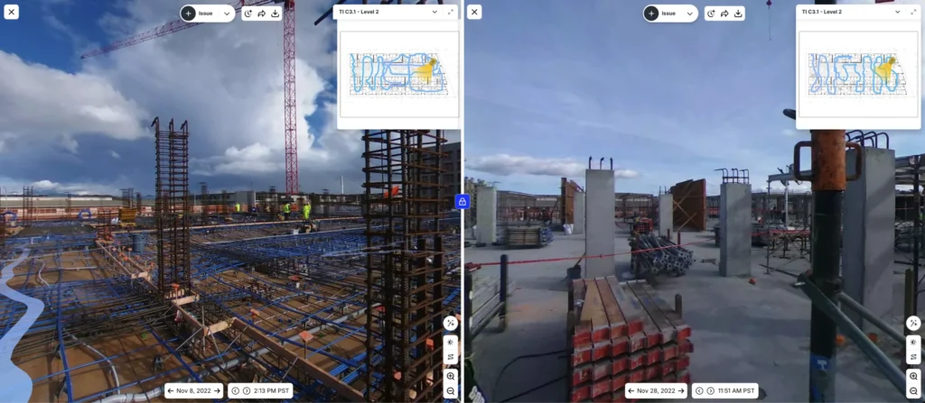
Get a consistent visual record across your portfolio
Capture a time-stamped visual record across every project, no matter the contractor or location, with smartphone and 360° capture. Add drone imagery for site logistics and exterior progress—even greater visibility on large, complex projects. We can even handle the capturing for you.
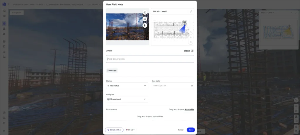
Manage risk. Meet obligations.
When you can see what was built and when, it’s easy to verify concealed work, resolve disputes, and keep the documentation you need for requirements like the UK Building Safety Act, ESG documentation, and warranty compliance. Even long after handover. Capture issues and track progress so nothing falls through the cracks.
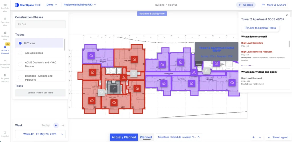
Track & see progress, without the travel
AI-powered progress tracking with humans in the loop for visual insights you can trust. See percent complete on portfolio dashboards for executives, asset managers, and project delivery leads—no need to wait for status updates. Spot risks early and understand what’s happening without the travel. Support facilities management handoff, tenant fitouts, pre-leasing tours, insurance claims, and long-term asset management with a visual history of your projects.

“In one current facilities management project, where I have to check what kinds of door openers are on each store across nearly 1,000 stores, OpenSpace saves me about $200-$250 per store that I would normally have to pay local field service technicians to physically go and take photos. We do these kinds of projects throughout the year, so that’s just one example of the savings.”
By the numbers
Why global owners, developers & hyperscalers choose OpenSpace:
41%
Fewer insurance claims & lower claim-related costs for owners & GCs using OpenSpace.
1000+
Data center projects running OpenSpace—from hyperscalers to colocation providers.
105K+
Homes using Visual Intelligence for L&Q, one of the UK’s largest housing associations.
All in one
Capture everything easily.
See it in one place. Connected with the tools you use.
Automated & powerful
AI does the heavy lifting—mapping images and delivering intelligence for confident decisions.
Reliable & accurate
AI-powered tracking with humans in the loop for unparalleled accuracy
Secure & proven
Trusted on 100K+ projects. SOC 2 certified.

Support & learning. On your time.

OpenSpace academy
Free, on-demand courses with easy-to-follow instructions, tips, and tricks.

Support
Our 360° approach to support: 24×6 support lines plus online support for advice and answers.

ROI
Resources for evaluating how OpenSpace can help you build faster and with less risk.

Frequently asked questions
What is OpenSpace?
- OpenSpace is the Visual Intelligence Platform for builders. For owners and developers, that means an independent, portfolio-wide visual record of every project you can rely on to make decisions, resolve disputes, and manage long-term assets.
- Capture every jobsite with smartphones, 360° cameras, and drones. Our Spatial AI engine turns that imagery into intelligence by anchoring it to time, place, and your plans and BIM. The result is a searchable, time-stamped, tamper-resistant record that outlasts the project itself.
- One platform, five products:
- OpenSpace Capture: the foundational visual record of your project
- OpenSpace Air: drone imagery for site logistics, exterior progress, and large-format sites
- OpenSpace Field: image-first coordination for owner reps and delivery teams
- OpenSpace BIM+: 3D model access for on-site verification
- OpenSpace Track: portfolio-level progress and risk grounded in reality data
- Used on 100,000+ projects across 131 countries, spanning data centers, infrastructure, residential development, commercial real estate, and manufacturing.
What is the difference between OpenSpace and other reality capture tools?
- Most tools produce photos. OpenSpace produces evidence.
- Every image is time-stamped, spatially indexed, and tamper-resistant. Anchored to your plans and BIM, searchable months or years later when a question comes up.
- Our Spatial AI engine organizes the visual record automatically. No labor overhead, no specialist required, no folders of loose photos.
- Standardized across your portfolio: every project captured the same way, comparable across sites, contractors, and geographies.
- The largest structured visual data foundation in construction (69 billion+ sq ft), which is why owners like L&Q have adopted it as a portfolio standard.
How quickly can I start capturing? How fast is your processing speed?
- Project setup takes 5 to 10 minutes. Upload plans, mark a start point, and capture.
- Multiple capture options: smartphone or 360° camera on a hardhat, with AI Autolocation in OpenSpace Field, or drone via OpenSpace Air for logistics and exterior progress.
- Images are ready to view in ~15 minutes on average, automatically aligned to plans and BIM.
- If you don’t have field teams on-site or want to standardize capture, OpenSpace Walk Services will do the walks for you.
How easy is it to roll out OpenSpace at scale and gain adoption?
- Owners typically deploy OpenSpace as a portfolio standard, requiring contractors to capture on a consistent cadence across all active developments.
- Adoption is fast because the tool adds little to no extra work for field teams. Works on Android and iOS.
- Integrates with Procore and Autodesk so it fits into workflows your teams and your contractors already use.
- Free, on-demand training via OpenSpace Academy, plus 24×6 support.
- L&Q signed a three-year agreement to deploy OpenSpace across its active development portfolio of 105,000+ homes.
Does OpenSpace work with drones?
- Yes, through OpenSpace Air. Import drone imagery and transform it into point clouds, 3D meshes, and orthomosaics, all inside the same platform.
- Most useful for owners on large-format sites (data centers, infrastructure, industrial) or for site logistics, groundbreaking documentation, and exterior progress on active builds.
- Compatible with DJI, Skydio, and Esri-supported drones.
Does OpenSpace use AI? What about AI agents?
- Yes, OpenSpace has been AI-powered since day one. Our Spatial AI engine locates every image in space and time, understands what is in it, and connects it to your plans, models, and workflows.
- Newer AI capabilities include AI Autolocation in OpenSpace Field (real-time indoor positioning without beacons or special hardware) and AI Voice Notes (spoken field context turned into structured, searchable data).
- On AI agents: agents are coming to construction, and they need eyes. The structured, portfolio-scale visual data on OpenSpace is the foundation agents need to operate. Owners stand to benefit especially, since portfolio-level agents can surface progress, risk, and compliance signals across every project at once. See the OpenSpace blog for more. [LINK]
Do big owners and developers work with OpenSpace?
- Yes, global developers, asset managers, hyperscalers, and public infrastructure owners rely on OpenSpace.
- Owner customers include L&Q (105,000+ UK homes), Lantis (major infrastructure owner in Belgium), Tishman Speyer, JLL, Sino Group, and Nedbank.
- 1,000+ data center projects globally use OpenSpace, including hyperscale and AI infrastructure builds. See our data centers page for more.
- Enterprise-ready: SOC 2, Cyber Essentials, FedRAMP Moderate Authorization, SSO, and regional data residency across the US, EU, UK, AU, CA, JP, KSA, and SG.
What other software does OpenSpace integrate with?
- Deep two-way integrations with Procore (Observations, Punch items) and Autodesk (Issues).
- Pull schedule data from P6, Asta, Microsoft Project, and Excel into OpenSpace Track for reality-grounded progress reporting.
- APIs (Images, Field Notes, Usage) and SSO for enterprise IT.