
Clarity from every angle
OpenSpace Air
Capture more. See more. Easily add drone imagery into our Visual Intelligence Platform—for a complete view of your project, ground to sky, indoors and out.
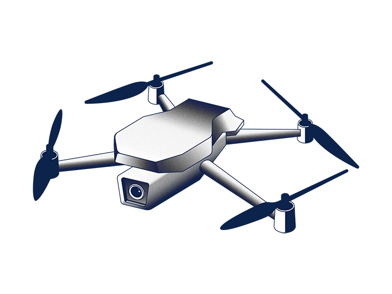
Capture with any drone
Capture your site with any industry-leading drone.
Processed in hours
View your orthomosaics, elevation models, meshes, and point clouds in hours, not days.
Review in one place
Review captures with easy-to-use tools—all in one app, with one login.
Analyze site conditions
Overlay site plans and drawings, measure to spot deviations, and keep the job moving.
No blind spots. No gaps.
OpenSpace Air brings drones into our easy, powerful Visual Intelligence Platform. Quickly access 360° captures, drone imagery, and laser scans all in one place—for complete project clarity, more efficient field workflows, and real savings.
Visual clarity from every flight
Automatically process imagery so you can easily compare, overlay, and visualize progress from the sky down.
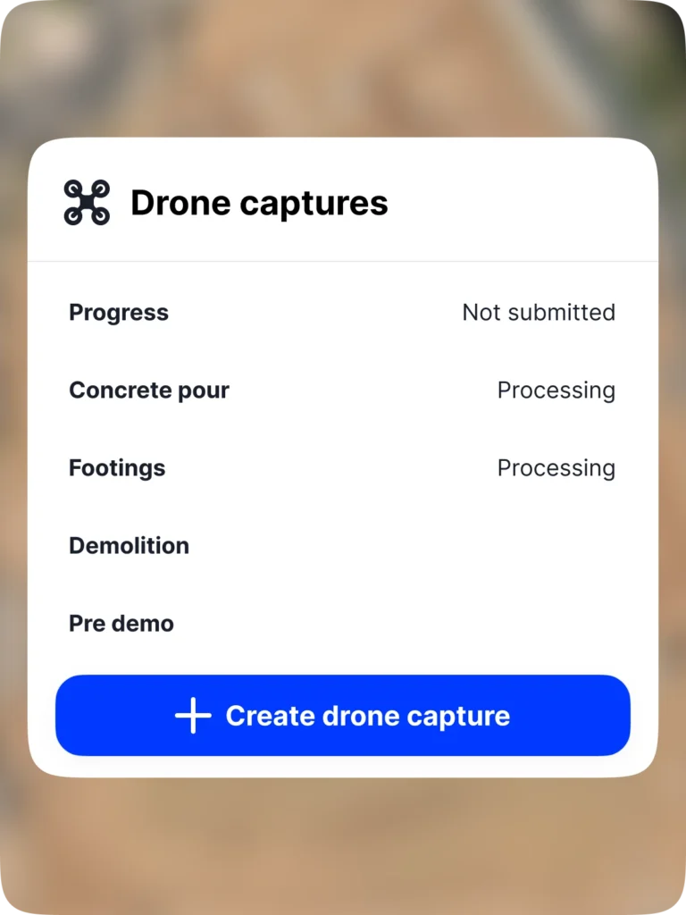
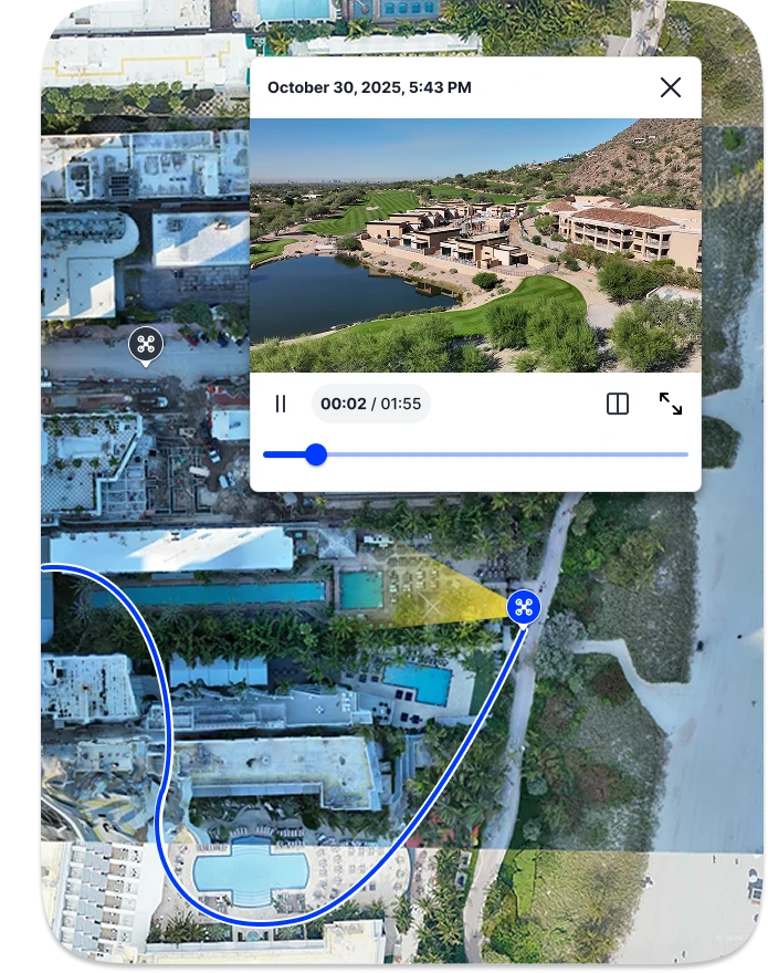
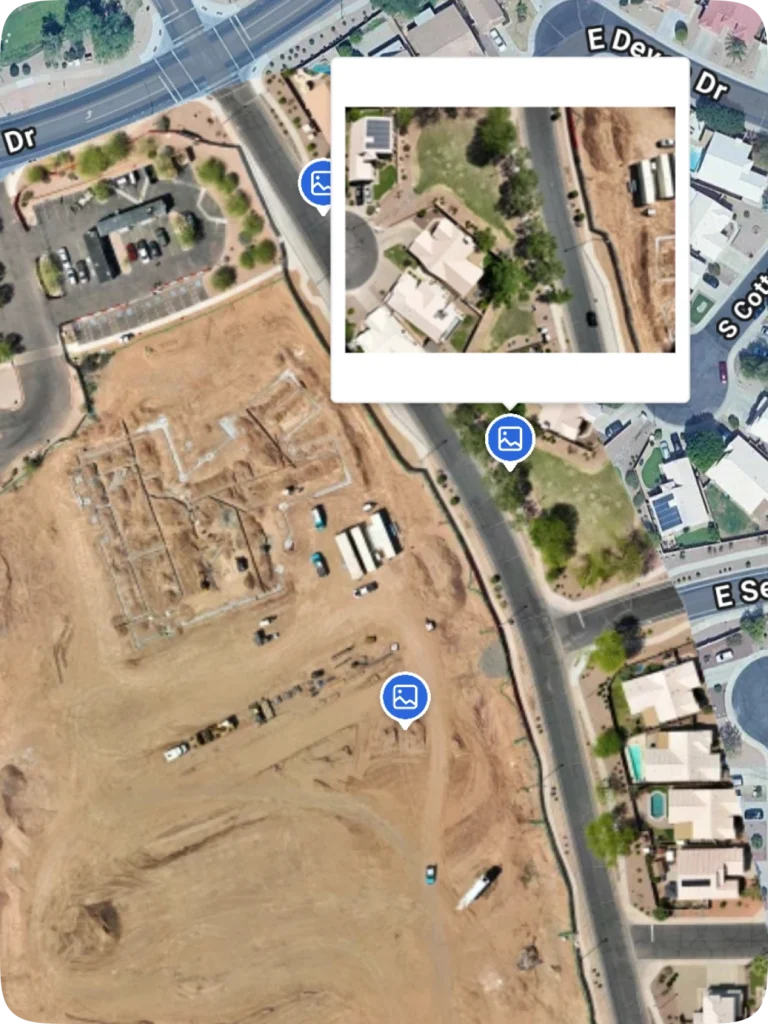
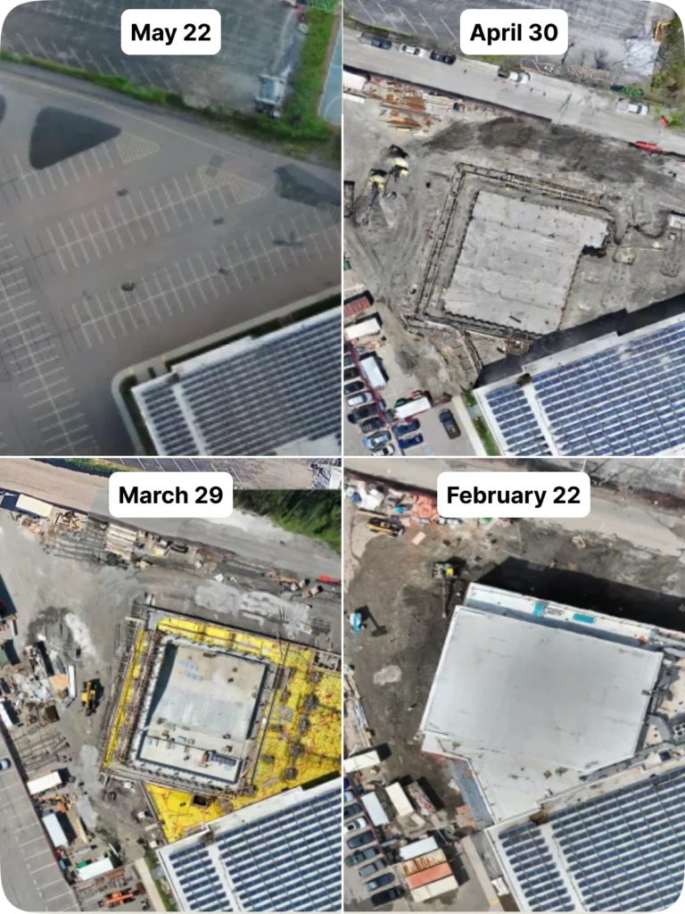
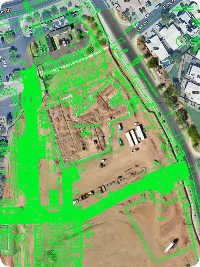
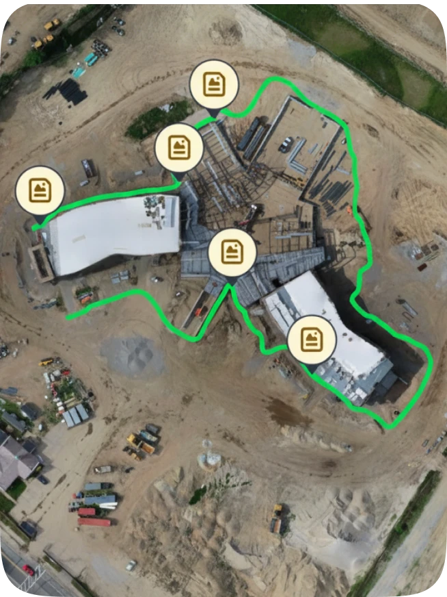
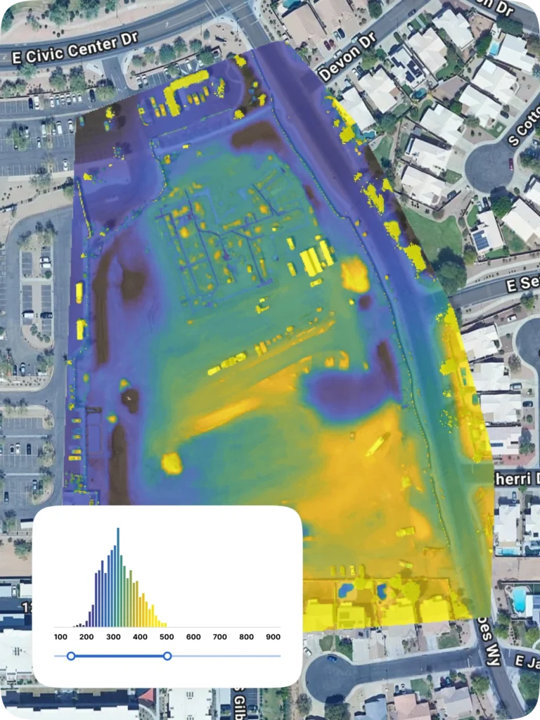
Image processing
Upload imagery from any drone and let OpenSpace Air do the heavy lifting—automatically generating high-quality orthomosaics, 3D meshes, and point clouds without changing how you fly. See our OpenSpace Air FAQ blog post for more.
Drone videos & panoramas
Capture site progress with immersive drone videos and panoramas. Give teams, clients, and owners a faster, clearer way to understand current conditions and communicate updates.
Additional images
Go beyond the bird’s-eye view. Inspect facades in detail or plan site logistics like crane placement, staging areas, and delivery routes with additional image captures.
Split view
View up to four orthomosaics side-by-side. Compare progress over time. Spot changes. Track work. Align your team with clear visual history.
Plan overlay
Layer in site plans, utilities, and other drawings directly on your captures to track progress, coordinate work, and resolve issues before they escalate.
Capturing on orthomosaics
Use drone orthomosaics as a base sheet for 360° captures from day one. Every capture is tied to up-to-date site conditions—even before drawings exist.
Insights you can build on
Move from observation to action. Measure, analyze, and track change with confidence—all without leaving OpenSpace.
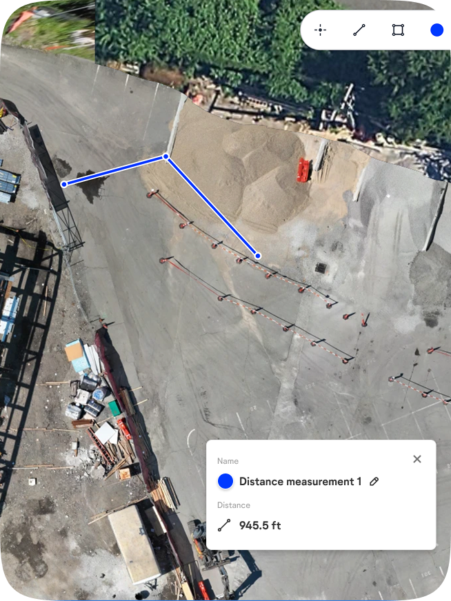
Distance measurements
Measure directly on your drone images. Quickly capture linear distances, 3D distances, and slope with an easy-to-use distance tool.
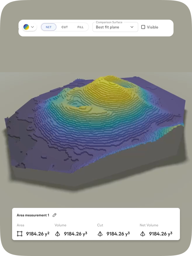
Area & volume measurements
Ideal for stockpiles and earthwork. Instantly calculate square footage, cut and fill values, and net volume. Compare any two flights to see exactly what changed—material added, material removed, and by how much. Export results as a CSV.
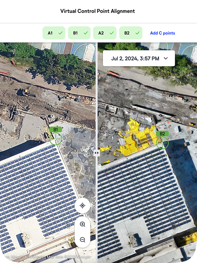
Virtual control points
Align captures from multiple flights with confidence—minus expensive survey equipment. Virtual control points keep orthomosaics locked to the same location. Measurements stay accurate. Progress is easy to track.

“With the drone data integration with OpenSpace, we can now expand outside the four walls of a building to show things that we weren’t able to see before, from an extremely valuable perspective. Overall, being able to identify items on the project earlier and create efficiencies in our platforms is a big win.”

Support & learning. On your time.

OpenSpace academy
Free, on-demand courses with easy-to-follow instructions, tips, and tricks.

Support
Our 360° approach to support: 24×6 support lines plus online support for advice and answers.

ROI
Resources for evaluating how OpenSpace can help you build faster and with less risk.

Frequently asked questions
What is OpenSpace Air?
Construction drones are taking on an increasingly important role. OpenSpace Air is a drone mapping software which gives you the power to import drone-captured data into the OpenSpace platform and transform it into valuable insights such as point clouds, 3D meshes, and orthomosaics. Our solution seamlessly integrates with all DJI, Esri, and Skydio drones, eliminating the need for multiple software platforms. OpenSpace Air delivers fast, automated drone image processing and seamless integration within your construction workflow.
Additional resources:
How is OpenSpace Air different than OpenSpace Capture?
OpenSpace Air complements OpenSpace Capture by enabling you to import drone-captured data into the same platform with your 360° reality capture data. That means you can leverage OpenSpace earlier in your projects, including drone captures during pre-construction and site preparation. By consolidating your aerial drone data and site imagery into a single platform, you get enhanced visibility, documentation, and progress tracking across the entire project lifecycle.
Do you need OpenSpace Capture to use OpenSpace Air?
Any company with an active OpenSpace Capture subscription has unlimited access to OpenSpace Air at no additional cost, including on projects where you are not using OpenSpace Capture. The integration of these two solutions ensures that all your site data—whether captured via drones or 360° cameras—is centralized in one platform, making project tracking and analysis more efficient.
What drones work with OpenSpace Air?
OpenSpace Air is drone-agnostic and designed for seamless compatibility with all DJI, Skydio or other drones. This means you can use your preferred drone hardware while benefiting from the advanced processing and analytics capabilities in OpenSpace.
Does OpenSpace Air work with any images or videos captured from a drone?
Yes, OpenSpace Air works with any JPG images with GPS data captured by any drone or drone app. Images can be processed into orthomosaics, point clouds, and 3D meshes or pinned to the map as additional images. Both manually captured or images from automated flights work.
Is OpenSpace Air available now?
Yes! OpenSpace Air is available today. If you’re an existing OpenSpace Capture customer, you can start uploading drone data into OpenSpace immediately to enhance your project documentation, analysis, and reporting. Current customers can contact their OpenSpace representative for help getting started. If you’re not yet a customer, request a demo to learn more.