Drones in construction have moved from a novelty flown for marketing footage to a working part of how sites get documented, measured, and verified.
Tighter schedules, distributed stakeholders, and constant pressure to prove what crews built and when have pushed builders across the construction industry to capture their construction sites from the air on a regular basis. The payoff is faster visibility across the whole site and a clearer, time-stamped record of work as it advances.
The aerial view is powerful, but teams get the most value when it sits alongside ground-level capture in one place. This guide covers what construction drones record, their benefits in construction, the use cases that matter most across construction projects, and where the technology is heading.
What construction drones capture on-site
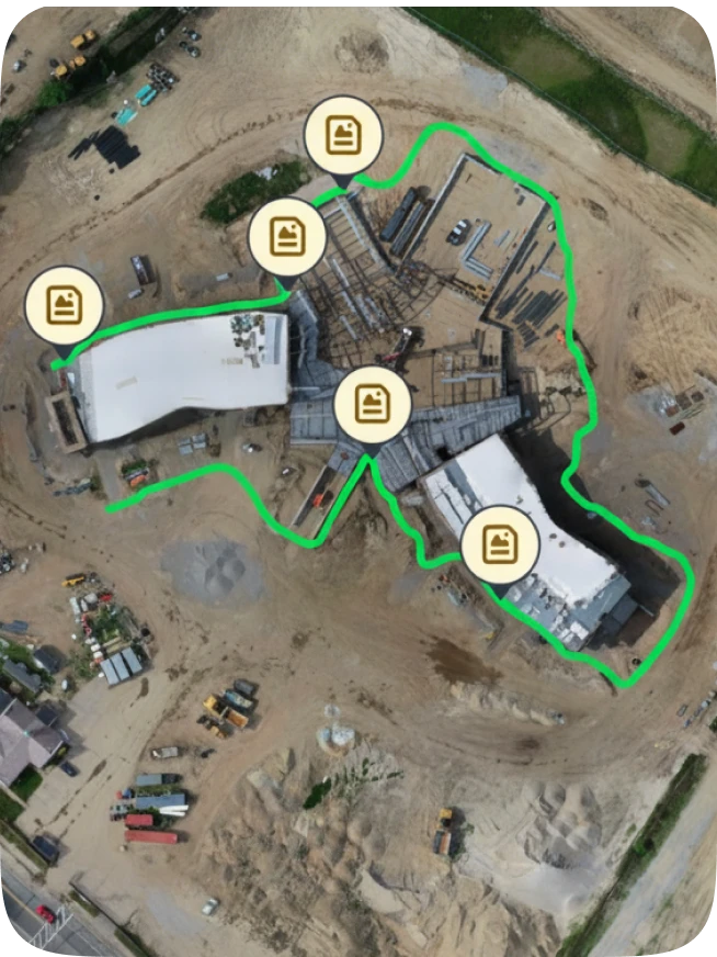
Construction drones capture high-resolution aerial images of a jobsite, which software then processes into orthomosaics, point clouds, 3D meshes, and elevation measurements. That output becomes the basis for site mapping, design checks, and earthwork volumes.
Most jobsite aircraft fall into two groups:
- Multirotor drones take off and land vertically in tight spaces, which suits active construction sites crowded with cranes and stacked materials.
- Fixed-wing drones cover larger construction sites and long linear work like roads or utilities on a single battery.
Both carry high-resolution cameras, and some add advanced sensors for thermal or multispectral capture.
Construction drones equipped this way collect detailed aerial imagery in minutes rather than the hours a ground crew would need. The high-resolution images feed into reporting after processing, and the imagery it produces supports accurate measurements you can act on.
What are the benefits of drones in construction?
The benefits of drones in construction come down to seeing more of your site, more often, with less time on foot. One flight records site conditions across the entire construction site, so the project team spends less time walking and more time acting on what they see.
Cost savings & fewer site visits
Cost savings show up quickly. Remote stakeholders review captures instead of driving out to construction sites, reducing unnecessary site visits and helps avoid the project delays that follow slow reporting. Regular flights also support inventory management by showing stockpiles and laydown areas without a manual count, and they give project managers an early read of site conditions before problems grow.
A clearer view of construction progress
Aerial captures give you a repeatable way to monitor construction progress. Comparing flights over time shows site progress at a glance and builds an objective record of project progress for owner updates, which is far harder to dispute than a verbal status call.
Safer inspections of hard-to-reach areas
Drones improve efficiency on inspections by reaching roofs, facades, and structural components without scaffolding. Sending an aircraft into hard-to-reach areas reduces manual inspections and keeps people out of fall-risk positions, which matters in construction, where falls are the leading cause of worker deaths. Fewer climbs and lift setups also help enhance safety without slowing the schedule.
“A flight every week tells you what the site looks like from above, but the work that drives disputes happens inside the building. Drywall goes up, MEP gets buried in the walls, a trade finishes a room and moves on. An aerial pass will never show you whether the rough-in was right before it got covered. The crews that get burned are the ones who trusted the flight and stopped walking the interiors. You need both: the drone for the site, ground-level capture for everything happening under the roof.”
—Jess Lam, Staff Product Manager, OpenSpace
Drone use cases across construction projects
Across construction projects, drones support surveying, progress monitoring, safety, and security from preconstruction through closeout. The strongest programs apply them to a few repeatable jobs rather than treating every flight as a one-off.
Drone surveying & site mapping
Drone surveying supplements ground crews for early site work before actual construction begins. A single flight delivers surveying and site mapping outputs with accurate positioning, giving construction surveying teams as-built conditions and precise outputs for grading and cut/fill.
Site surveying tasks that previously required days of field collection can often be completed in hours, giving teams faster access to existing site conditions for planning and decision-making. Accuracy depends on flight planning and ground control: a peer-reviewed study in the journal Drones found that positioning technique and ground control point distribution largely determine the accuracy of UAV mapping.
Progress monitoring & reporting
Progress monitoring is the highest-value use for most firms. Drone construction monitoring lets you track site progress week over week and feed it into project management systems, so site monitoring becomes part of the construction process instead of a separate chore.
Site safety & security
For site safety, safety inspections drones use to document conditions for compliance also let crews inspect dangerous areas without putting workers in harm’s way, including spots that would otherwise need a lift. For site security, regular flights across construction sites improve overall site security by flagging unauthorized access and recording the yard after hours.
“Surveying gets the headlines, but progress monitoring is where I see the clearest return. A weekly flight gives the project manager a time-stamped record of what got built and when, and that record settles the conversation in the owner meeting before it turns into an argument. Owners stop asking for status because they can see it. When a flight from three weeks ago shows the slab was poured on schedule, nobody is relitigating the timeline. That is the use case that pays for the program.”
—Jess Lam, Director of Product, OpenSpace
Where aerial capture falls short on its own
Aerial captures show the outside and the big picture, but they cannot see inside finished walls, follow daily trade work, or replace ground-level detail. That gap is where most disputes and rework begin.
Aerial flights are periodic and outdoor by nature, so they work best paired with ground-level capture.
| Capture method | Strongest at | Blind spots |
| Aerial drone capture | Site-wide context, earthwork and grading, roofs and facades, and overall progress | Interiors, daily trade work, and anything under cover |
| Ground-level 360° capture | Interiors, trade-level detail, and time-stamped walkthroughs of finished spaces | Site-wide overview and large-scale measurements |
Between flights, interiors keep changing, and drone imagery of the entire site from above will not show you a mechanical room or a closeout punch. Relying on aircraft alone leaves holes in the record that the older traditional methods of scattered phone photos never filled either. Drones in construction work best as one input among several.
Pairing aerial flights with reality capture in construction builds the continuous visual record a Visual Intelligence Platform draws on to help teams understand what changed.
Bringing aerial & ground capture into your construction workflows
When aerial and ground capture live in one platform, aerial imagery becomes part of your everyday construction workflows. OpenSpace Air, part of the OpenSpace Visual Intelligence Platform, lets you import drone imagery into the same place as 360° ground capture, then compare flights over time and connect the outputs to progress tracking.
That combination is what construction professionals increasingly expect. Suffolk Construction, an early OpenSpace Air customer, brought its drone program into OpenSpace to consolidate aerial and ground documentation in one system rather than juggling separate apps.
For builders running a drone program across many projects, this is where drone operations get easier to scale: one login and one record, in a workflow your field teams already know. As more firms integrate drones with project management and BIM, aerial outputs feed coordination and project plans directly instead of sitting in a folder no one opens.
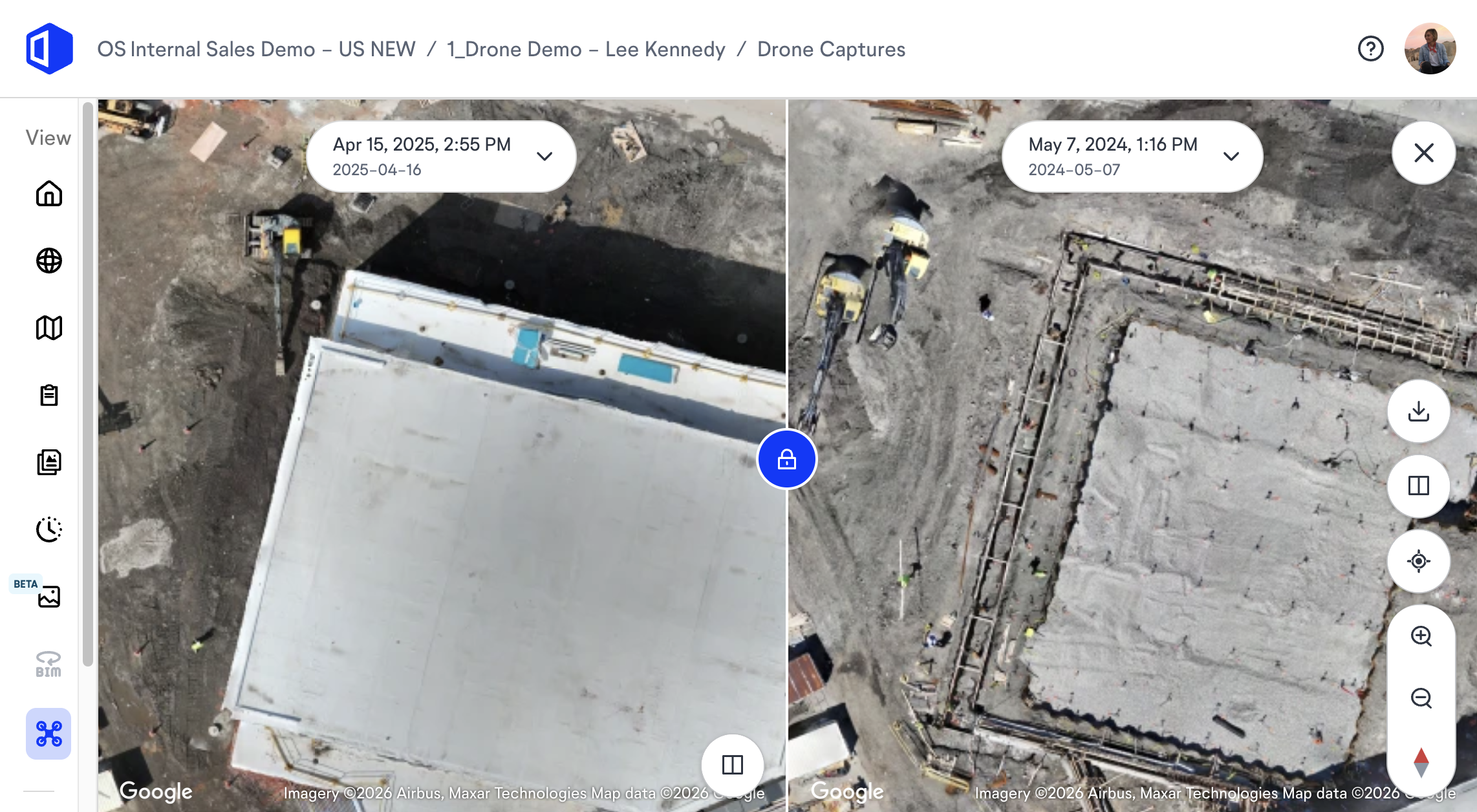
“The change is that the field team stops switching between apps to tell one story about the project. When the aerial flight and the 360 walkthrough live in the same record, you scroll from the roofline straight down to the mechanical room without leaving the project. Nobody is exporting images into a deck to prove progress. The superintendent pulls up one view in the field, and the owner sees the same view in the office. That is when the documentation stops being a chore and becomes how the job runs.”
—Jess Lam, Director of Product, OpenSpace
See how OpenSpace Air brings drone and ground capture together. Request a demo.
Future trends for drones in the construction industry
In the construction industry, the next phase is less about the aircraft and more about what happens after the drones fly. Drone technology is maturing toward automated, repeatable flight paths flown within visual line of sight under current safety regulations, which makes aerial capture consistent enough to compare week over week.
Expect tighter links between drone applications and the rest of the stack. AI is increasingly being applied to aerial and ground-level imagery together, helping teams identify changes, track progress, and surface insights from large visual datasets.
Drone use is also widening: unmanned aerial vehicles handle everything from environmental monitoring drones tracking runoff to routine site checks, and drone software is becoming standard rather than specialist. For modern construction projects, the firms that pull ahead treat drones in construction as part of one record rather than a standalone gadget.
Frequently asked questions
How much does a drone cost in construction?
A commercial-grade construction drone usually ranges from about $1,500 to $25,000 or more, depending on camera quality, sensors, and payload capacity. Entry-level multirotor models cover basic site photos, while survey-grade systems with onboard RTK positioning sit at the top of that range. Most builders also budget for software, training, and a certified pilot when standing up a drone program.
Do you need a license to fly a drone on a construction jobsite?
Yes. Flying a drone for commercial work on United States jobsites requires an FAA Part 107 Remote Pilot Certificate. The rule covers any aircraft between 0.55 and 55 pounds flown for business, and pilots must keep it within visual line of sight, so confirm local airspace rules before flying near airports.
How accurate is drone mapping for construction measurements?
Drone mapping can reach centimeter-level accuracy when flights use ground control points or RTK positioning. Standard flights without correction still work well for visual tracking but are less precise for grading and volume calculations. Accuracy depends on flight height, camera quality, image overlap, and how you place ground control points.
See it on your own projects. Ready to bring drone and ground capture into one record? Request a demo or contact your OpenSpace representative to see what OpenSpace Air can do for your projects.