Reality capture is propelling construction risk management into an exciting new era, and as the global leader in reality capture and AI-powered analytics, OpenSpace is increasingly recognized by the insurance industry. In fact, OpenSpace just won the PropTech Breakthrough Award for Rental Insurance Product of the Year. Moreover, carriers like AxaXL, Travelers, and Shepherd reward builders for using OpenSpace. You can listen to my talk with Shepherd CEO Justin Levine to hear his perspective on ways the insurance industry is shifting to keep pace with technological innovations like reality capture.
For example, a partnership with Shepherd grants OpenSpace customers access to its Casualty Pro excess liability insurance offering, providing qualified contractors with underwriting credits and improved coverage on their Shepherd insurance policies based on their OpenSpace usage.
Using OpenSpace Capture, builders attach a 360° camera to their hard hat and simply walk the site as normal. Once the video from the walk is uploaded to the cloud, OpenSpace’s computer vision technology stitches images together and pins all the images to the floor plan, creating a trusted visual record of site status. Powered by OpenSpace’s Vision Engine, an immersive digital replica of the jobsite is ready to view in 15 minutes on average after upload, and users can virtually walk through sites from anywhere as easily as using Google Street View.
OpenSpace customers typically have a lower risk profile because they can build with greater certainty and catch potential safety issues and costly mistakes before they happen. Consistently capturing jobsites with OpenSpace gives builders the insights to make informed decisions about safety, along with data to minimize disputes and increase accountability. For example, they can more easily spot and take action to remove or correct safety risks such as missing toe boards, improper railings, and pooled water, and can improve day-to-day safety by referring to OpenSpace data in QA/QC meetings.
That steady stream of field evidence is what turns construction risk management from a preconstruction exercise into something teams can act on while the work is still in front of them.
Carriers writing larger civil and infrastructure projects also reward teams running drone construction site monitoring progress, since the aerial record makes safety patterns visible across the whole site at once.
Moreover, the software helps builders simplify the claims process, thanks to the robust visual documentation that 360° captures provide. With this data, safety and project teams have increased transparency and can collaborate more efficiently to expedite the process with the ability to look back in time and see the state of the project prior to and after an incident or weather event. Builders can share OpenSpace visual documentation with claims adjusters to create a comprehensive story showing which items were on-site and the actual site conditions at any point in time.
Having the right images can reduce the need for inspector site visits, help avoid disputes or litigation, and even increase the amount of money paid out in claims. For fire protection contractors, that visual audit trail is especially critical because sprinkler and piping installations are hidden behind drywall within weeks, and without a captured record there is no way to prove what was installed correctly.
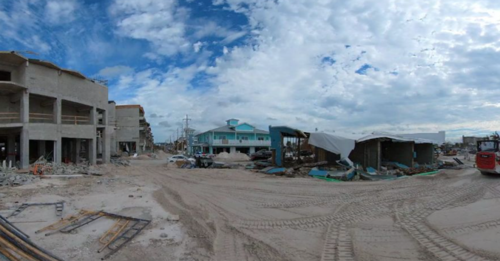
When Hurricane Ian wreaked havoc on the west coast of Florida in 2022, OpenSpace customer DeAngelis Diamond produced OpenSpace captures showing the insurance adjuster exactly what the space looked like before and after the storm. Within a month of landfall, DeAngelis Diamond was able to get back to work because the adjuster was comfortable with the documentation. I spoke with the company’s Chief Administration Officer and Project Engineer to get the full story, which you can hear in this on-demand webinar.
Builders that use OpenSpace deliver their projects faster and reduce the risk of trade partners falling behind schedule. For example, when Suffolk deployed OpenSpace on a 53-story residential tower, the company was able to accelerate project delivery by one month and was able to keep all of its subcontractors on schedule. Our case study goes into detail about this project and shares other ways that Suffolk has benefited from OpenSpace, including improved accountability and transparency.
Ultimately, the insurance industry is recognizing that OpenSpace mitigates risks on projects and improves loss ratios. Capture data and automated progress tracking simplify the claims process by creating greater transparency throughout the build, providing indisputable visual documentation, and safely accelerating project delivery. We’re here to help whenever you’re ready to explore the benefits of OpenSpace reality capture.