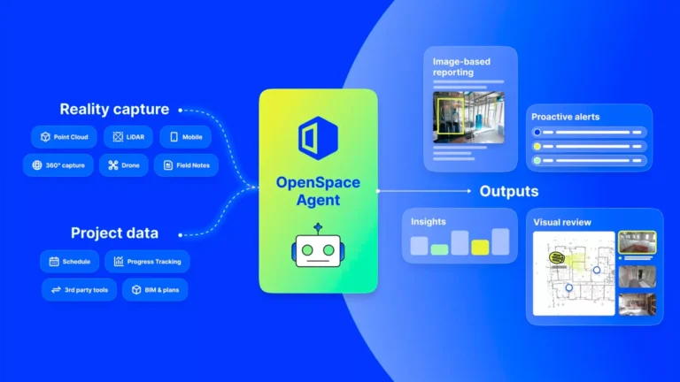
Best International Project covered OpenSpace’s Waypoint 2026 announcements in depth, spotlighting AI Autolocation 2.0 with Live Location, Site Mode, Walk and Talk, expanded Track capabilities, and the new OpenSpace Agent Ecosystem. The piece stands out for its editorial depth, placing each new capability in the context of OpenSpace’s product history and the broader shift toward Physical AI in construction. For the built world audience that BIP reaches across architecture, development, and construction technology, the coverage reinforces OpenSpace as the platform defining how the industry understands and acts on what is happening on site.
Best International Project covers property development, architecture, and construction technology for an international professional audience spanning the full project lifecycle, from architects and developers to technology evaluators on active sites. The article’s depth sets it apart: rather than summarizing a press release, BIP traces AI Autolocation from its 2025 introduction through Live Location and Site Mode, and frames the Agent Ecosystem in the context of earlier spatial AI prototypes OpenSpace disclosed a year earlier. That kind of editorial treatment signals genuine recognition that what OpenSpace is building is a category shift, not just a product update. The platform that began with 360° reality capture is now the layer connecting the physical jobsite to the AI agents that help teams act on what they find there.
The BIP article also highlights how the Agent Ecosystem works: agents built by OpenSpace or by partners via MCP can access visual and spatial data that has been captured, organized, and mapped to its location within a project. That is a meaningful distinction from AI tools that operate only on documents and schedules. OpenSpace’s foundation of more than 110,000 projects and 77 billion square feet of analyzed imagery gives agents the ground truth they need to assist with daily logs, inspections, and punch list work in a way that generic AI cannot replicate. The Track API extends this further, enabling progress data to flow into ERP systems, BI dashboards, and PM tools, and opening the door to faster subcontractor payments based on a verified visual record.