As we announced at Waypoint 2023, we’ve released our latest product, OpenSpace BIM+. We wanted to take a deeper dive and walk through some of the most powerful features of this exciting new offering.
Design and engineering professionals have broadly adopted BIM, but it hasn’t gained the same degree of traction among field teams. While 3D models are an essential aspect of construction, working with them presents numerous hurdles that can drive up project costs and delay schedules. For one thing, these models are complex and require specialized hardware and a lot of computing power. They’re also difficult to navigate, relative to the 2D drawings that many in the field prefer, and you typically need an expert with specialized skills to work with them.
To compensate for these and other challenges, field teams usually end up incurring excess hours of the VDC manager’s time to handle routine informational requests throughout every project. As a result, BIM has been a wedge that has solidified silos and limited coordination between field, office, and VDC teams. At the same time, however, reality capture technology is becoming widely embraced on construction sites, which provided a unique and timely opportunity for OpenSpace to help unite these teams.
Enter OpenSpace BIM+
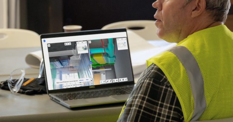
Now in Early Access, OpenSpace BIM+ will dramatically simplify BIM viewing and make it actionable in the field, strengthening coordination between office and field teams. By bringing BIM to the field via our reality capture solution, our goal is to enhance coordination, save valuable time spent on day-to-day tasks, and equip field teams to be more efficient.
This suite of easy-to-use 3D tools is built for everyone and will make BIM more of a self-serve function, unlocking BIM coordination on the jobsite. Teams can compare as-built conditions to design intent in the office and on the construction site. Using OpenSpace BIM+, field teams can navigate and compare site conditions to the project’s model as easily as navigating a Google Street View, making it easy to answer questions quickly and resolve issues without the typical back-and-forth that can happen daily on a jobsite. With streamlined workflows, VDC managers and others have more time to focus on critical path items.
These new tools are built on top of our industry-leading OpenSpace Capture solution, a combination that transforms communication by letting your images and models do the talking. Teams can not only view and compare BIM to as-built, but they can also actually take action in a more efficient manner by coordinating with team members directly in OpenSpace.
Key features of OpenSpace BIM+
Now in Early Access as an add-on to OpenSpace Capture, OpenSpace BIM+ functionality will accelerate BIM and field coordination workflows. It strengthens coordination by working with our popular BIM Compare and Field Notes features to push out relevant information to project stakeholders and through multiple systems and project management platforms. It also enhances analysis and provides greater context to project teams by exposing different types of data, making models easier to navigate with new features like Saved Views, and simplifying the ability to compare as-built to design intent. OpenSpace BIM+ also improves model management by bringing in models from where they’re stored, allowing teams to have multiple models in the OpenSpace platform, and providing visibility into how project teams are using and adopting models.
Powerful BIM analysis tools
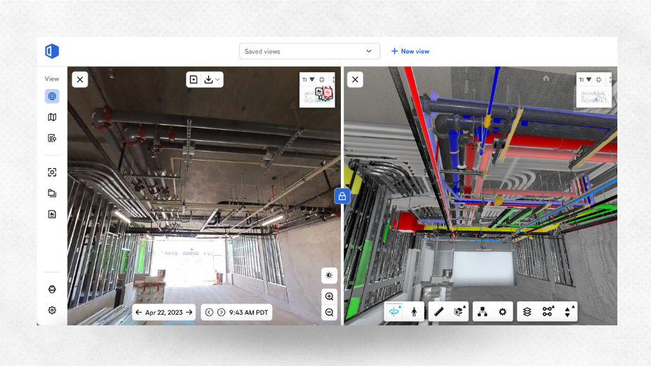
Navigating and analyzing BIM in the field often require the time and expertise of a VDC manager. OpenSpace BIM+ analysis tools expedite this communication by empowering field teams to easily work in the BIM and compare the model to what they’re building. Project team members can easily navigate to saved views in the BIM, review model elements overlayed onto the 360° photos, and access the model from any iPhone, iPad, or Android device, even when offline.
Moreover, you can now store, view, analyze, and share point cloud data in OpenSpace from mobile and terrestrial laser scanners and OpenSpace’s 3D Scan feature, bringing critical reality capture data to one central location.
And, using a new Saved Views feature, teams can create and save preset layers and views in BIM Compare. Users can then select a saved view from a dropdown list, making it simple for anyone to access and use BIM data, with no model navigation expertise required.
Time-saving BIM coordination tools
Construction projects require tremendous coordination, and OpenSpace BIM+ includes features designed to help teams quickly solve problems by aligning design intent with on-site conditions to speed up responses, approvals, and project schedules.
With OpenSpace BIM+, you can significantly improve BIM workflows by creating Field Notes based on a BIM Compare view that include the 360° image and model. This new functionality enables field teams to add detailed images and notes during site walks or back at their desks. Having the BIM Compare visual in the Field Note, teams can quickly document issues, clashes, and misalignment between on-site conditions and design intent, strengthening coordination and keeping projects moving forward.
We’ve also added a BCF file export tool, enabling streamlined workflows with leading BIM coordination tools like Revizto, Navisworks, and BIM Track. Teams can export multiple Field Notes to a BCF file and then import them as issues into any solution that accepts BCF format.
Simplified model management
Keeping your model current streamlines the design and construction process by ensuring all stakeholders have access to the most current information. Using OpenSpace BIM+, project teams can easily import their models into OpenSpace directly from BIM 360 Docs and Autodesk Construction Cloud (ACC) Build. Doing so will save time thanks to this streamlined process, eliminating the manual two-step process of downloading a federated model and then uploading the file to OpenSpace. OpenSpace BIM+ also simplifies the task of managing updates to BIM with support for multiple models and provides visibility into how team members are adopting the models through model usage reporting.
Watch this space! Many more features will be rolling out soon. For further details on OpenSpace BIM+ and to sign up for the early access program, visit our OpenSpace BIM+ page or reach out to an OpenSpace representative.


