For Project Engineers on construction projects, the typically labor-intensive manual photo documentation process can siphon attention away from more important tasks. Taking dozens of photos with a digital camera, uploading them, organizing them, and embedding them into presentations takes several hours. And this process needs to be redone frequently in advance of cross-functional stakeholder meetings, imposing a burden on field teams.
Manually documenting progress photos is also notoriously imprecise since it’s difficult to take pictures from the same angle when you’re relying on your memory from week to week. Attempting to get the same shots each month is part of what makes traditional photo documentation so difficult.
A site documentation checklist takes some of that guesswork out, giving every walk the same set of shots to capture so the record holds up even when a different engineer runs it.

Traditional methods of capturing progress photos also mean that the same PE who started the documentation has to be the one to resume it, making it difficult for that person to lighten their workload during weeks when their capacity is stretched thin—not to mention if they are out sick or get moved to a different project.
The PE team from NOVO, a construction firm based in Menlo Park, Calif., was deeply familiar with these challenges. When the company started using OpenSpace to capture job sites, teams were struck by how it exponentially increased their productivity while saving them time.
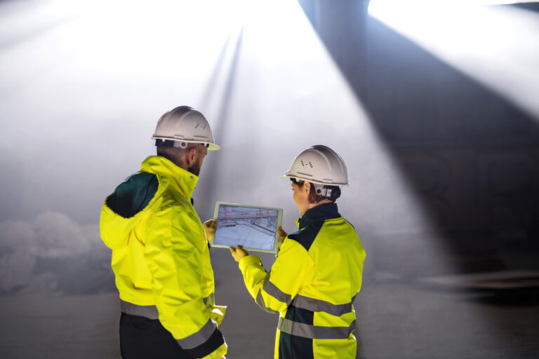
Since OpenSpace’s 360° photo documentation software automatically positions images on project plans, organizing them by date, PEs no longer have to struggle to organize pictures they’ve taken. In addition, they no longer have to block off time to take photos; they simply mount an off-the-shelf 360° camera to their hard hat and let OpenSpace’s site mapping software run while conducting their normal job walk.
“With OpenSpace, it’s immensely faster, because the capture is connected to the project plan and the imagery is automatically positioned on the plans.”
“In the past, I would fall behind because I typically do captures at the end of the day,” said Tyler Rohde, a Project Engineer at NOVO. “It took so long to manually organize the photos. With OpenSpace, it’s immensely faster, because the capture is connected to the project plan and the imagery is automatically positioned on the plans.”
OpenSpace also dramatically improves the quality of 360° photo documentation, and its side-by-side image comparison feature enables quick, cost-effective change orders. On one recent project, for example, a PE noticed that HVAC had been installed in the wrong place and looked out of place. NOVO redid a portion of it and then used OpenSpace’s side-by-side BIM comparison feature to quickly align with the owner and architect, who approved completing the repair. If the mistake hadn’t been identified so quickly, it would have been costlier and more difficult to correct.
The same early-catch logic applies to safety hazards, where a documented record is often what separates a near miss from one of the incidents behind the industry’s injury numbers.
Ultimately, OpenSpace’s 360° photo documentation technology has reduced the time to capture, upload, and map imagery by 95%, freeing up NOVO’s Project Engineers to complete other work. It’s also improved their workflows by making it easy for anyone on the project team to access imagery and immediately apply it instead of relying on the memory of the PE who initially captured it.
“I just got an intern last week, and he’s already proficient in using OpenSpace,” said Rohde.
To learn more about how NOVO is documenting job sites 20 times faster and capturing 100 times more imagery with OpenSpace, download the case study.