Anser Advisory works with developers and municipalities on heavy civil construction projects such as freeways, ramps, and interchanges. Due to the size and scale of the company’s typical projects, it would be virtually impossible for the construction management team to manually take pictures of every detail in order to have a complete record of every project. As a result, it was sometimes challenging to find relevant documentation if public inquiries were made or contractor disputes arose.
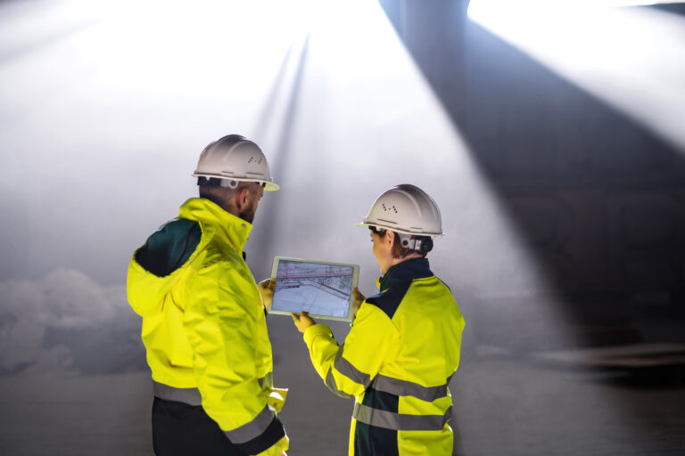
In 2019, Anser began piloting OpenSpace for 360° photo documentation, drawn to how easy it was to use. To document a site, an inspector previously had to go around with a phone or camera and try to figure out what was most critical to capture. OpenSpace only requires someone to walk the site with a 360° camera attached to their hard hat; they don’t even need to think about photo documentation. With OpenSpace, inspectors can effortlessly capture all the details of a project site, including signage, striping, and pavement conditions, while remaining focused on their inspection work. It’s also easy to keep the record up-to-date by simply walking the site every day.
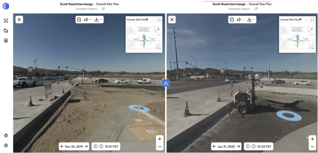
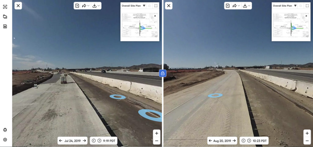
During their initial projects using OpenSpace, Anser’s construction management team quickly understood its potential beyond reduced documentation time. The ability to reproduce job site conditions via comprehensive 360° photo documentation that’s automatically mapped to project plans was invaluable. Being able to revisit any area on any date turns captured imagery into a continuous timeline of the build, which makes it much easier to verify when work was completed and spot trends across the schedule.
“A picture is worth a thousand words; OpenSpace is worth a billion words,” said Lucas Rathe P.E., a Resident Engineer at Anser Advisory. “It creates a full world.”
In particular, OpenSpace is indispensable for large-scale grading operations, since Anser can easily track day-to-day progress by contractors and refer back to it if there’s a claim. Anser also uses 360° photo documentation to respond to claims from the public; in the event of a claim about potholes, for example, the construction management team can easily pull up a photo of the location and day in question.
OpenSpace also has implications for Anser’s workflows around vegetation control. On a recent project, the team had to demonstrate that every guardrail post had a foam block-out to prevent weeds from growing before the client would give approval for concrete to be poured. OpenSpace’s 360° photo documentation software makes it simple to pull up relevant imagery captured during site walks and drop them into client-ready presentations in these scenarios.
As a result of using OpenSpace, Anser is gathering at least 10 times more photo documentation than before, when construction management teams were taking photos manually—and much more sporadically. They’ve also found OpenSpace to be at least five times faster than taking pictures with a digital camera or a phone.
“It’s an insurance policy,” Rathe said. “Project sites are unpredictable by nature, but whatever happens, you’re covered.”
In addition to the reduced documentation time, Rathe is also realizing time savings by using OpenSpace’s Virtual Walkthrough feature, which allows him to experience current site conditions from his computer. As a result, he doesn’t have to drive between project sites as often. He estimates that virtual walkthroughs are saving him at least a few hours of commuting time each week, improving his overall productivity.
To learn more about how Anser Advisory is using OpenSpace’s 360° photo documentation technology to create a more complete record of project sites and reduce documentation time, download the case study.