
Coordinate
Coordinate visually, stop the guesswork
Coordinate from the same visual record, mapped to your site, and connected to your most important workflows. No guessing. Teams aligned and work moving forward.
Get a demo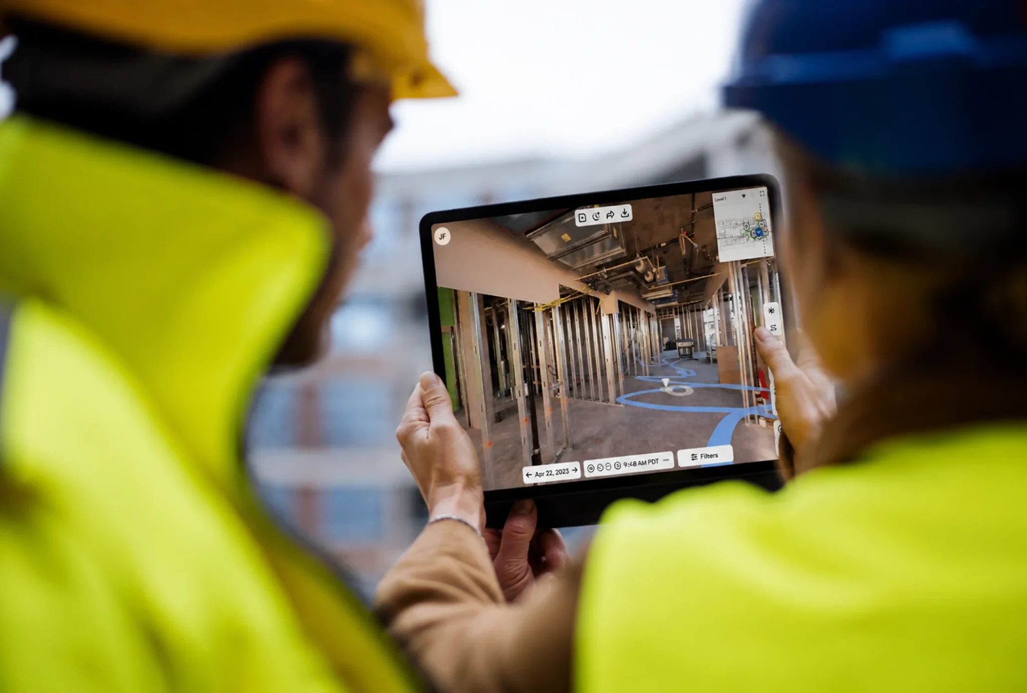
Coordinate with confidence & keep work moving
Documents and opinions don’t cut it for coordination. See what’s truly happening with OpenSpace. Spot issues. Avoid rework. Stay on track. The easier it is to coordinate, the more reliable the handoff.
Verify work & resolve issues
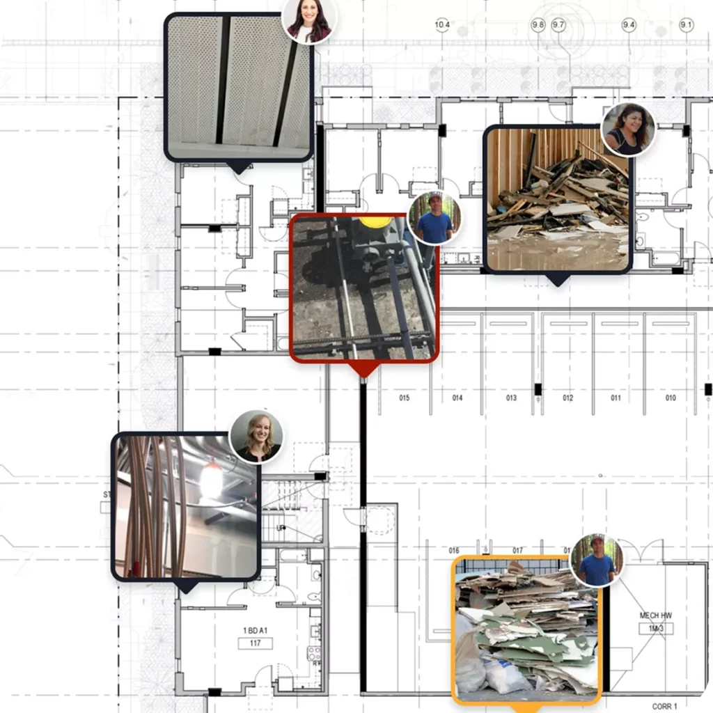
Catch issues before they become rework. See site conditions with 360° imagery, photos, and Field Notes—all tied to location. From verifying work to QA/QC walks to punch lists, every issue comes with visual proof you need to resolve it fast.
See your site through time
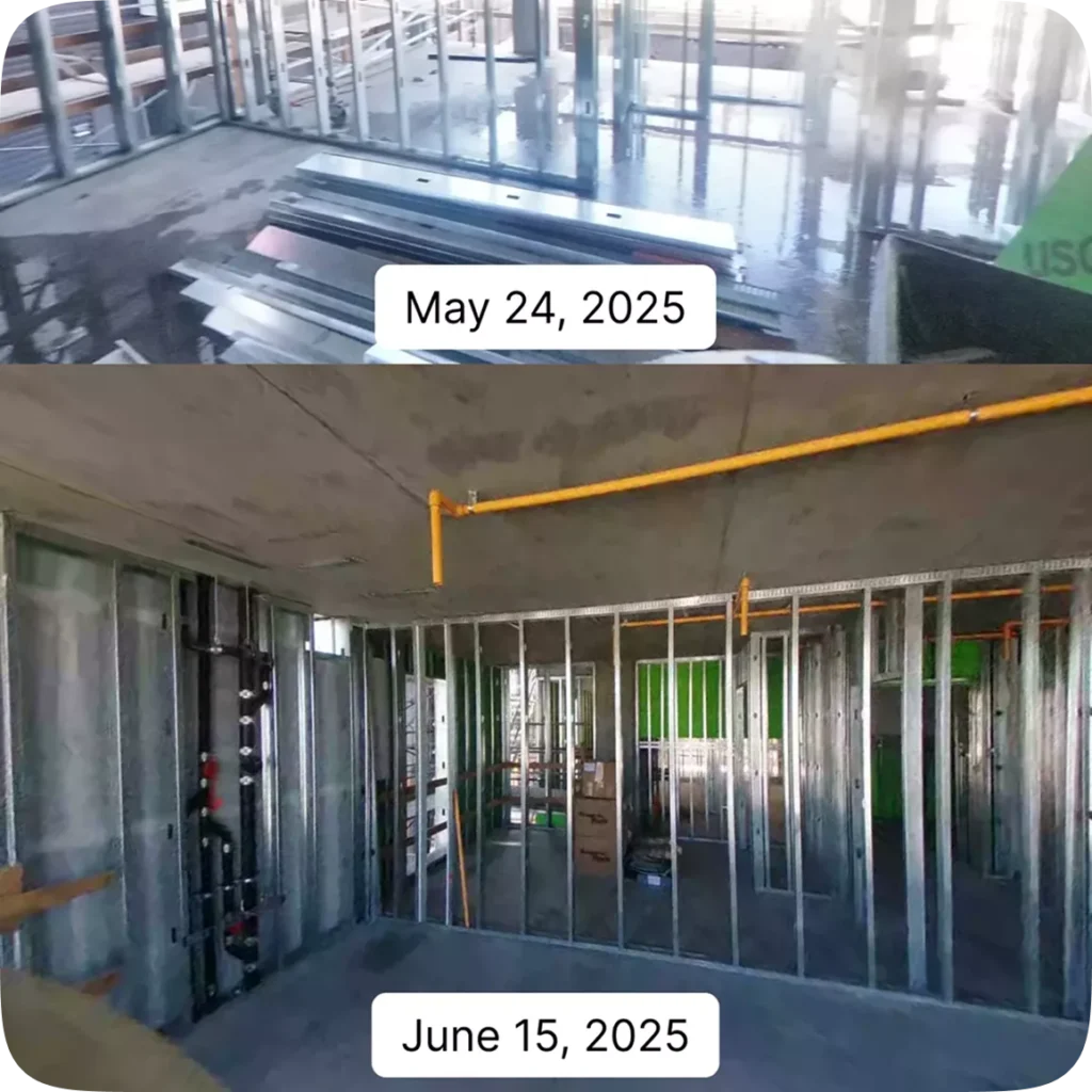
You need to know the status of your site to coordinate what comes next. Compare today’s site conditions to yesterday’s—or last month’s—and instantly see what’s changed. Verify completed work, answer questions faster, and resolve disputes.
Compare as-builts to design intent
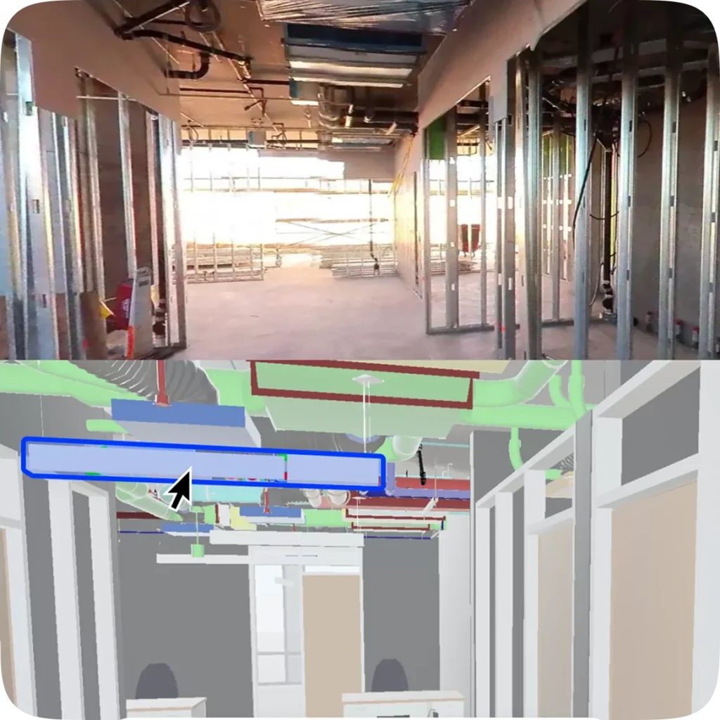
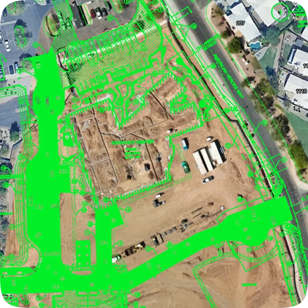
Compare what’s built to design—from site logistics to individual building elements. Overlay design documents on drone imagery, compare BIM next to installed work, and send issues to Revizto, so coordination gaps get closed instead of lost.
Earthworks & preconstruction
Site coordination starts before a wall goes up. Get elevations, measurements, volume calculations, and cut/fill analysis—all from up-to-date drone imagery—so you can manage earthworks and verify site conditions with confidence.
Progress tracking
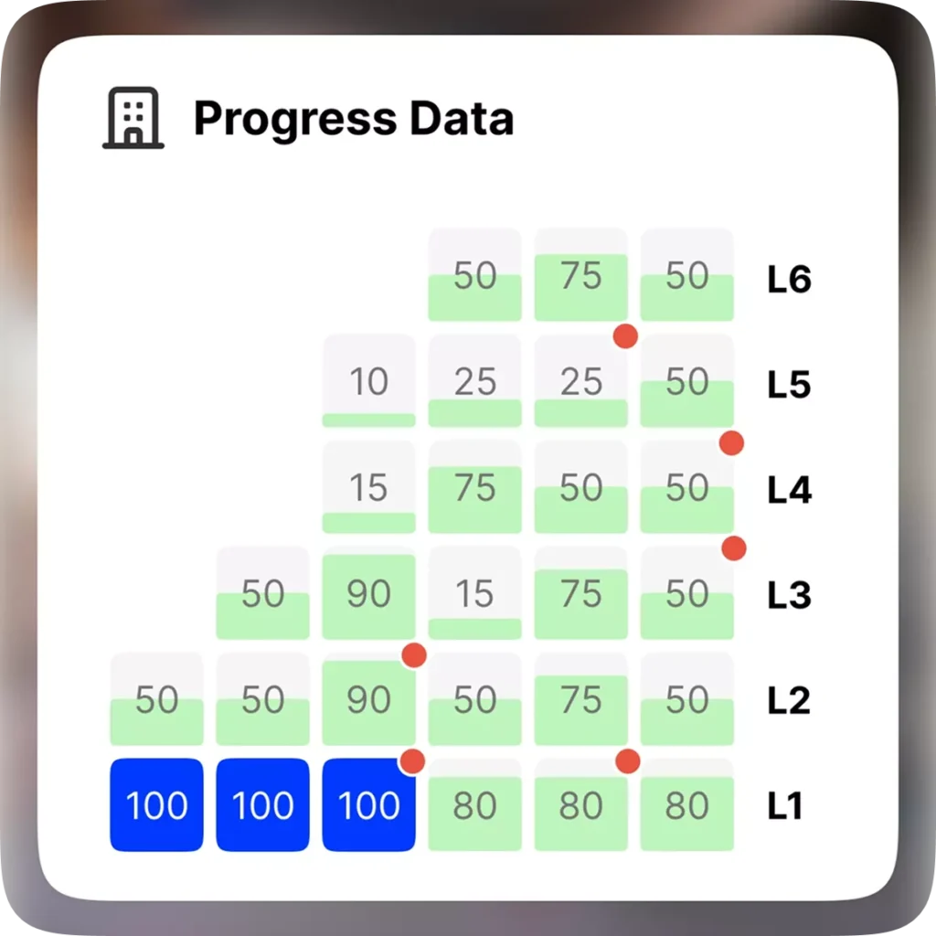
AI-powered tracking, backed by human review, for accuracy you can trust. Because every day behind schedule costs money. Track progress by trade, floor, or zone. Compare what’s been built against your schedule. Access dashboards for an instant view of project health, and detailed reports to dig deeper.
“OpenSpace allows us to have real-time coordination with our project teams when they’re remote. If we walk on a Tuesday and have an RFI meeting on a Wednesday, we can pull up that walk and the model and clarify and coordinate issues in real time.”