
Visual Intelligence, in your pocket
MOBILE APP
Bring Visual Intelligence into the field. Capture your site, document work, collaborate with your team, and access BIM—all from the phone in your pocket.

Capture, collaborate & coordinate in the field
The field is where the action is. OpenSpace makes every site visit an opportunity to capture what’s happening, document issues, coordinate work, and keep projects moving. All connected in one platform. And our mobile app runs on what you run: iOS or Android.

Fast, effortless capture
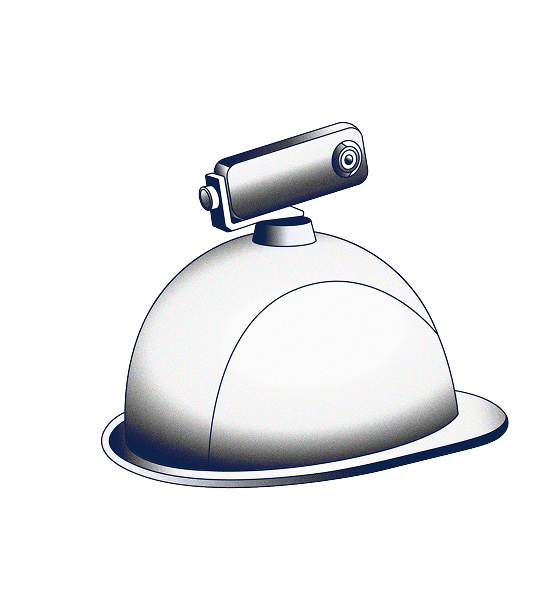
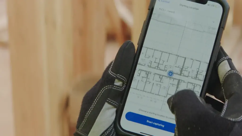
Turn your phone into a powerful capture device. Connect a 360° camera in seconds with QuickConnect or capture photos directly from your phone. OpenSpace automatically maps every image to your floor plan, and even works offline—so documenting your site fits naturally into every walk. Later, find what you need fast with AI Search.
Collaborate where work is happening
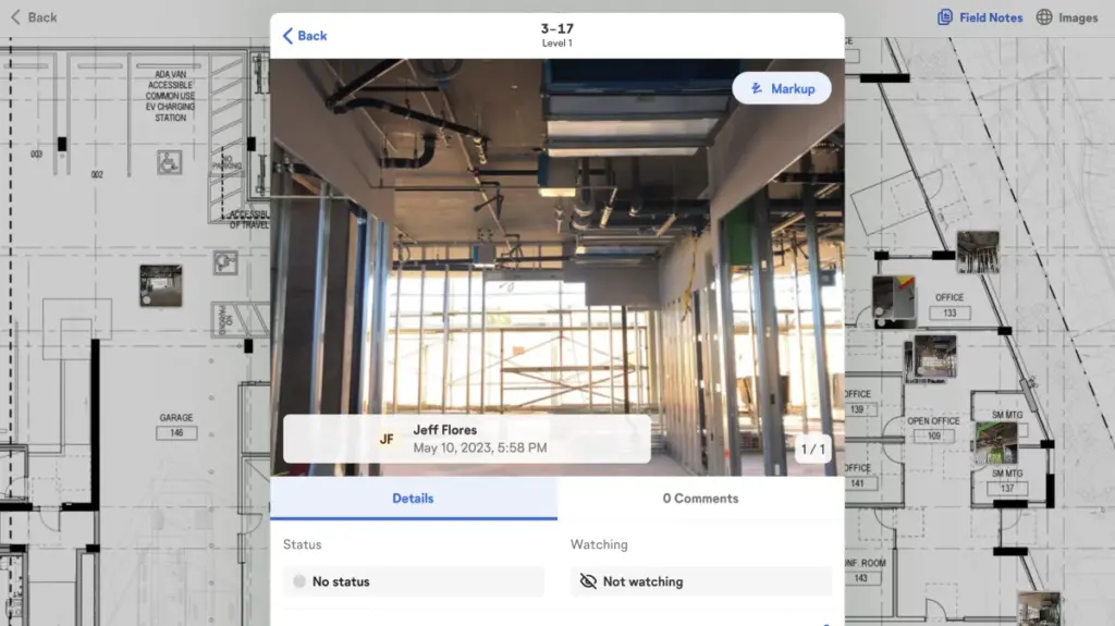
See something that needs attention? Log it as a Field Note during a 360° capture. OpenSpace automatically timestamps and maps everything to the right location. Or create a Field Note anytime with a photo; AI Autolocation pins it to the right spot on your plan. Use AI Voice Notes to log your issue hands-free. Plus, create Autodesk Issues or Procore Observations and Punch List items and directly in OpenSpace, with two-way sync keeping everything aligned.
Easy BIM access in the field
Navigate and compare site conditions to your fully aligned model with BIM Compare on your phone or tablet: toggle layers on and off, snap measurements, and use Sheet Overlay to connect the 2D drawings you check daily to your 3D model. With OpenSpace BIM+, go further: view multiple models, jump to a Saved View, and access the BIM viewer offline.
“Everyone in the field totally relies on OpenSpace. It always has our backs.”
Efficiency in the field
Our mobile app keeps pace with builders in the field: fast, complete documentation and easy access to your capture data, wherever you are, so you can answer questions and keep moving.
Navigate your as-built over time
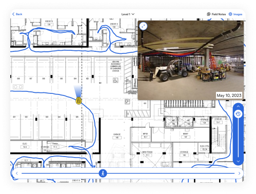
Fast and intuitive navigation: jump to any point in time with the time slider, fly through the capture path with the location slider, or drag and pan across your floor plan. Explore captures with the 360° pano viewer, and use Reveal Mode to overlay a past capture onto what’s in front of you, then slide to reveal what’s covered up or built over.
Compare progress with Split View
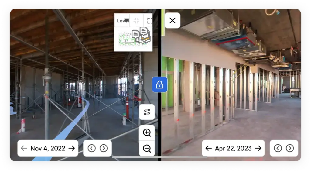
Destructive investigations, and the patch backs and reinstallations that follow, cost time and money. Use Split View on your device to compare a location from two different dates side by side, so disputes about what was installed, and when, get answered fast.
Capture measurable 3D scans
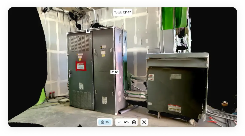
With 3D Scan, use your LiDAR-enabled iPhone or iPad to capture an accurate 3D scan with two-inch measurement accuracy. In minutes your team can measure spaces, verify conditions, and answer installation questions from anywhere. If you use terrestrial laser scanners, import that point cloud data with OpenSpace BIM+ to view it on your device.