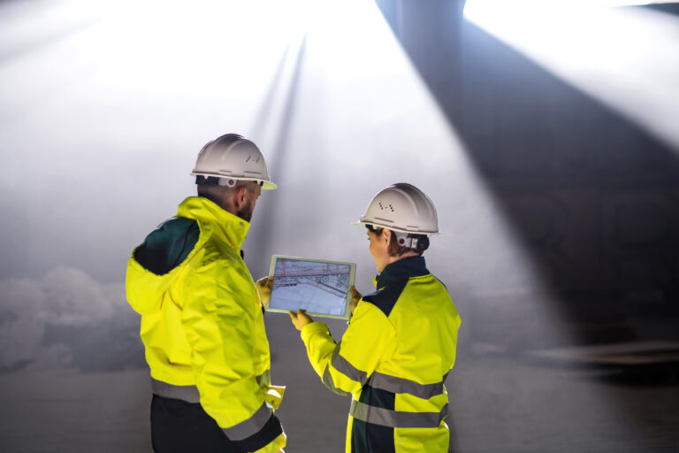
Reality capture has changed how construction teams visualize and manage projects. It replaces scattered, time-consuming manual photo documentation with complete visual records of jobsite conditions. Beyond documentation, reality capture that seamlessly integrates with Building Information Models (BIM) significantly improves office and field collaboration.
Reality capture starts with capturing existing conditions
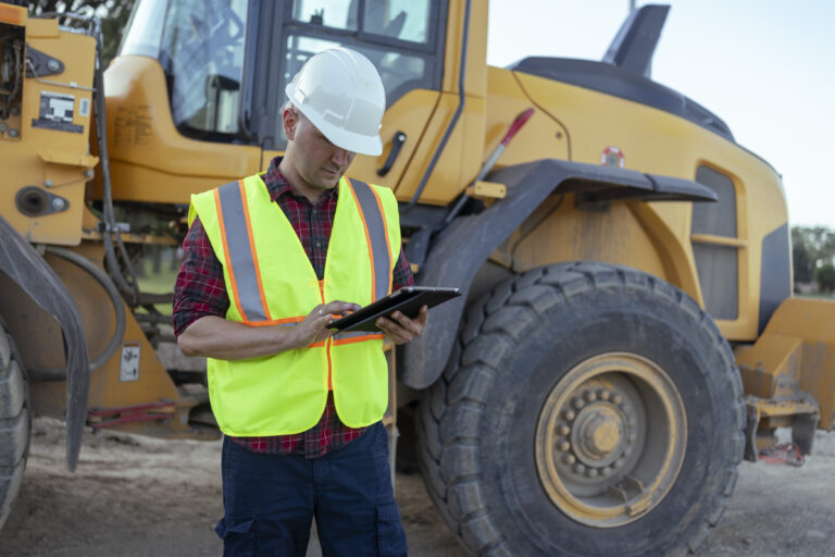
Reality capture uses 3D laser scanners, 360° cameras, and drones to create digital representations of construction sites. Of those tools, drone site surveys cover the ground the others cannot—the sitework, roofs, and exterior elevations that a handheld scanner or hardhat camera will never reach. And the smartphone already in a superintendent’s pocket can document issues on the spot, anytime, without specialized hardware or extra steps.
With as-built visual records of a project, construction professionals can:
- Take measurements and understand spatial relationships.
- Identify potential issues early in the design phase.
- Make well-informed decisions during planning.

How does reality capture help track construction progress?
With reality capture, you’re not waiting for someone to report back from the field. You can see what’s actually been built, where things stand against the schedule, and what needs attention before it turns into a delay.
The ability to virtually navigate a jobsite helps project managers:
- Track progress effectively.
- Identify deviations from the construction schedule early.
- Make prompt adjustments to minimize delays.
Comparing as-designed models with reality capture data also gives you a leg up on quality control. You can quickly identify any deviations from design specifications, leading to timely corrections and ensuring that construction meets standards.
How does BIM improve collaboration in construction?
BIM gives every team on a project—architects, engineers, contractors, and owners—a shared view of what’s being built and what’s been decided. Instead of chasing the latest version of a drawing or reconciling conflicting information across disconnected documents, everyone works from the same coordinated model.
That shared foundation changes how teams communicate. Clashes get caught in the model before they become field problems. Scope questions get answered faster because the information is already there. And when something changes, everyone sees it, not just the people who happened to be in the right meeting.
How does BIM improve information management?
BIM serves as a central hub for managing and organizing project data, enabling professionals to access and update information from any location, improving real-time collaboration. This centralized approach to information management helps reduce errors, minimize miscommunication, and improve overall project efficiency. For instance, one study found that poor data management and communication issues cost U.S. contractors and construction managers over $31 billion annually in rework expenses.
How is BIM used for facility management?
Once a project closes out, the BIM model doesn’t stop being useful. Facility managers can pull up detailed information about every system in the building—mechanical, electrical, structural—without digging through paper records or chasing down the contractor who originally did the work.
That access makes day-to-day operations more manageable and long-term planning more accurate. Facility teams use BIM to:
- Optimize space management.
- Develop effective preventative maintenance programs.
- Improve energy efficiency and reduce operating costs.
- Facilitate system retrofits and facility improvements.
This comprehensive approach to facility management helps building owners and managers make informed decisions throughout the building’s life, ultimately leading to more efficient and cost-effective operations.
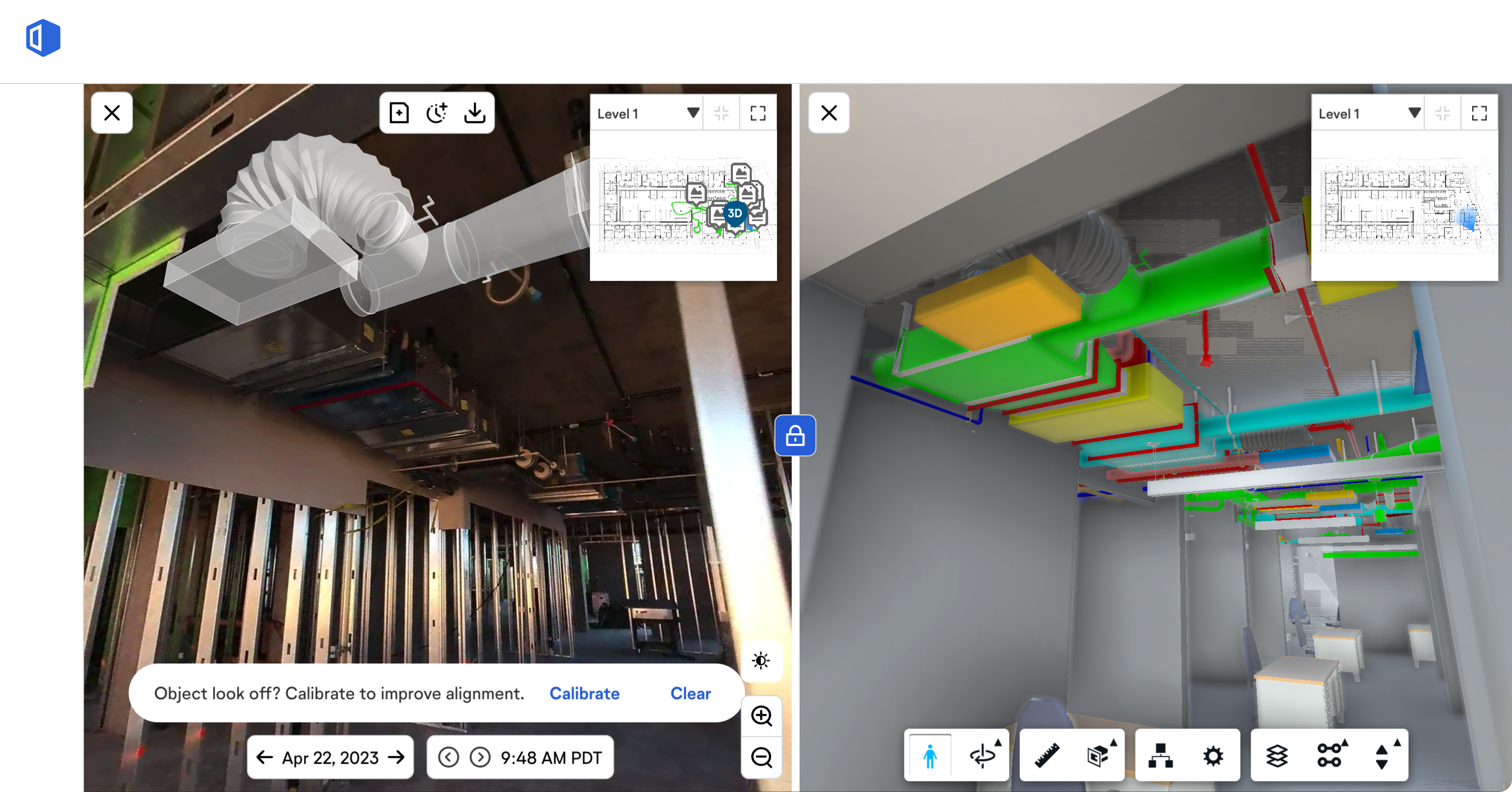
How is reality capture data integrated into BIM?
The integration of reality capture data into Building Information Modeling involves a workflow that enhances the accuracy and efficiency of construction projects. This process combines advanced construction AI technologies to create a comprehensive digital visual of the as-built environment.
Data capture & processing
The workflow begins with data capture, which forms the core of the scan-to-BIM process. 3D laser scanners and other advanced technologies collect measurements of the existing site conditions. These tools generate millions of data points, creating a detailed point cloud model that represents the scanned area in three dimensions. The accuracy of this initial data capture is crucial, as it directly impacts the quality of the final BIM model.
Once captured, the point cloud undergoes processing to remove noise and refine the data. This step ensures that the information is clean and ready for integration into the BIM environment.
Alignment & registration
After processing, the point cloud data is aligned and registered with the existing BIM model. This step involves superimposing the as-built point cloud onto the as-planned model. To facilitate this process, localization is performed to recognize the location of model components by estimating the relative position of the sensor in the virtual BIM coordinate system.
How is the BIM model validated using reality capture?
Teams validate the BIM model by comparing it directly against the point cloud captured on-site. Where the model and reality diverge, someone flags the discrepancy and resolves it before it carries forward. The result is a model that reflects what’s actually been built.
What challenges come with reality capture and BIM integration?
Technical hurdles & solutions
The integration of reality capture and BIM faces several technical challenges. One major hurdle is software interoperability, which can lead to issues resulting in inaccurate information exchanges. To address this, organizations need to focus on developing standardized data formats and protocols. Another challenge is the complexity of managing and processing large amounts of reality capture data. Implementing robust data management systems and utilizing cloud-based solutions can help overcome this obstacle.
Cost considerations
While reality capture and BIM integration offers numerous benefits, there are initial costs. Organizations must invest in specialized hardware, software licenses, and employee training. However, the long-term benefits often outweigh these upfront expenses. To manage costs effectively, companies can start with pilot projects to optimize workflows before full-scale implementation. This approach allows for gradual adoption and helps identify the most cost-effective solutions for their specific needs.
FAQs
What is reality capture & how does it function?
Reality capture involves the creation of a three-dimensional model of a physical space or object using various sensing technologies such as laser scanners, cameras, and drones.
What advantages does reality capture offer in the construction industry?
Reality capture delivers enhanced insight into projects, streamlined operations, and improved accuracy—all helping to reduce project timelines, cut costs, and elevate client satisfaction.
Can you explain what 3D reality capture entails?
3D reality capture is a technique used to digitally model a site, such as a building, plant, or crime scene, in three dimensions. This process combines both imagery and precise measurements.
What does the scan-to-BIM process involve?
The scan to BIM process involves converting digital models obtained from laser scans into a format usable within BIM systems. These systems help interpret the data and incorporate it into a 3D model for use by design, development, and construction teams.
If you’re interested in a live demo to see the many use cases for OpenSpace, schedule your OpenSpace demo here.