
2025: An inspirational year of innovation & building
As the year wraps up, I want to say something pretty simple: ...
December 5, 2025
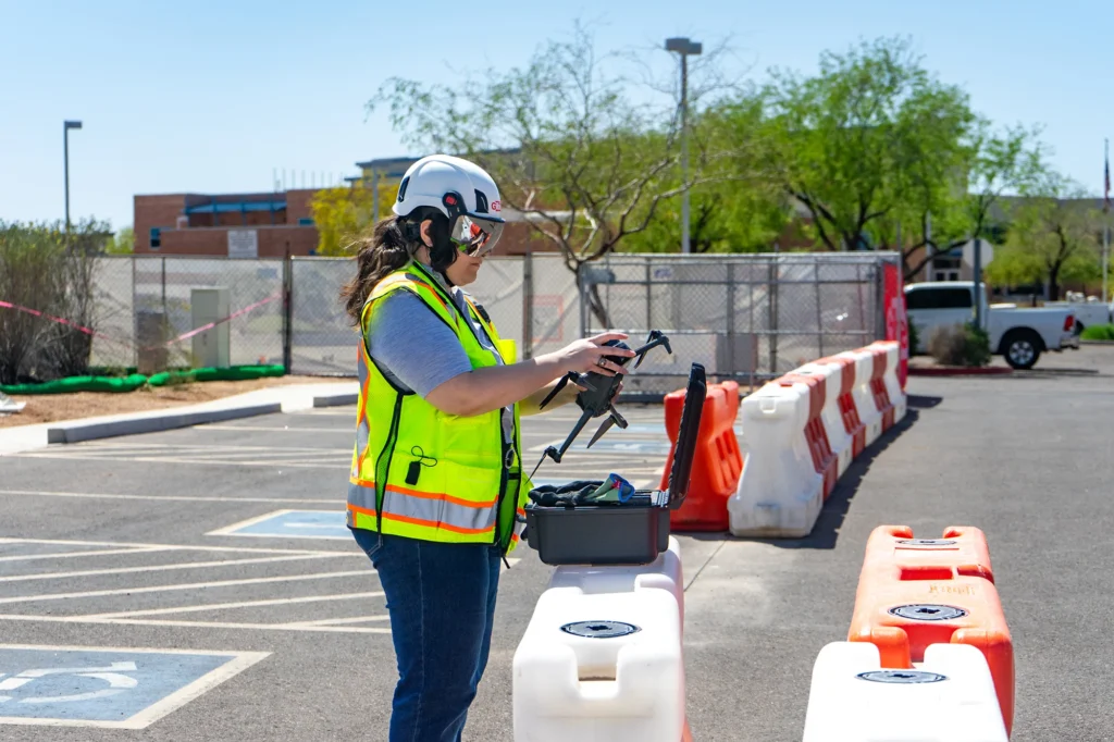
Construction project management teams rely on drones for real-time visibility from day zero—improving safety and reducing costly rework. Five of the top drone use cases in construction are progress tracking, site surveys, safety inspections, earthwork analysis, and stakeholder reporting.
And solutions like OpenSpace Air make these tasks easy to achieve. With OpenSpace Air, it’s simple to add drone imagery into our Visual Intelligence Platform, where we process it automatically, and connect it with other project data for a complete view of your site.
Here’s a look at these top five use cases:
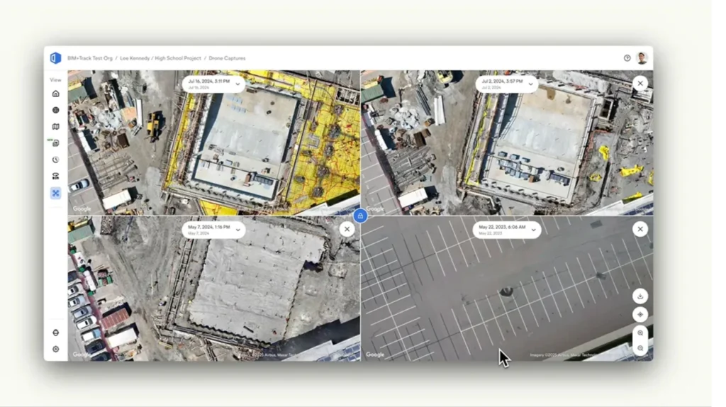
The first way drones support construction project management is by helping you track progress over time. With drones, you can capture high-resolution aerial imagery that provides a clear record of how work is advancing—without needing to walk every inch of the site.
A general contractor using OpenSpace Air uploads drone captures weekly to automatically generate orthomosaics and 3D meshes. Project managers can then use Split View to compare up to four captures side by side to display progress over the course of multiple weeks or months, spot deviations from design intent early with the drawing overlay feature, and share progress visuals directly with owners—all without leaving the OpenSpace platform.
Drones have become an essential tool for site surveying and preconstruction planning. Specifically, you can capture accurate topographical data and generate maps and point clouds in a fraction of the time it takes using traditional surveying methods.
Civil contractors use OpenSpace Air to automatically create 3D meshes and orthomosaics from standard drone flights. You can easily export the resulting files into the formats you need for uploading into tools like ArcGIS and Civil 3D for accurate planning and design validation.
Our next use case for taking advantage of drone imagery in construction is improving safety with remote inspections and monitoring. Instead of sending folks into hazardous or hard-to-reach areas, you can use drones to safely capture images and videos from above.
A safety manager uses a drone to capture aerial overviews of their active zones and staging areas. After ingesting drone imagery into OpenSpace Air, they can layer the captures with site plans to verify barricade placement and ensure clear pathways for equipment and on-site teams. You can make these visuals, plus every drone image geolocated over the base map in full resolution, available to the rest of the safety team and pertinent stakeholders.
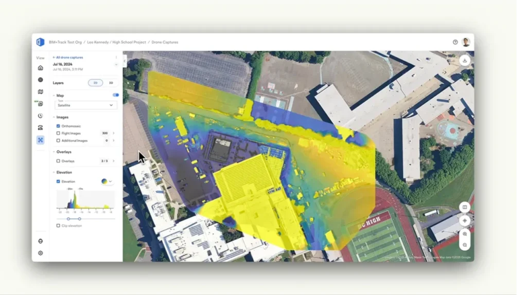
Drones make earthwork and volume measurement faster, easier, and more accurate than ever. By comparing drone-generated topographic data over time, teams can calculate cut-and-fill volumes and accurately monitor progress.
Using OpenSpace Air, site engineers analyze grading and excavation areas with cut-fill functionality and elevation models generated from their drone captures. That gives them more accurate reporting and reduced risk of costly over-excavation.
Note that 2D and 3D measurement functionality will be launching in OpenSpace Air in the coming weeks. With these powerful and accurate measurement capabilities, users will be able to streamline site analysis, improve accuracy, and reduce manual surveying time for construction and earthwork projects.
Drone imagery is super effective for keeping all stakeholders informed. Having high-quality visuals makes it easy to clearly communicate project updates to clients, investors, and leadership teams—without requiring technical expertise.
Owners and developers use OpenSpace Air to help create visual reports that combine aerial and 360° captures. Everyone—from executives to field teams—can see progress and make faster, more confident decisions.
With OpenSpace Air, you can upload imagery from any drone and we’ll automatically create high-quality orthomosaics, 3D meshes, and point clouds. With drone imagery added to our Visual Intelligence Platform, you have a single, easy-to-use place to access all your site imagery—from drones, smartphones, 360° cameras, and laser scanners.
The result? Clarity from every angle—making it fast and easy to turn imagery into intelligence you can use to manage projects efficiently, reduce risk, and make decisions with confidence.
Drones are used for surveying, progress tracking, inspections, logistic planning, and reporting. They capture high-quality visual data that helps teams manage sites safely, efficiently, and accurately.
Drone imagery improves visibility from day zero, reduces site visits, enhances safety, and saves time. You can also use your drone data to generate accurate documentation for billing, QA/QC, and schedule tracking.
Yes. Platforms like OpenSpace Air can help you manage and produce drone data that can be ingested into popular tools such as ArcGIS Pro and ArcGIS Online, Autodesk systems like ACC and Civil 3D; plus project management systems like Procore and many more. All creating one central source of truth for project reality.
By capturing aerial data quickly and safely, drones minimize the need for manual inspections and provide early warnings of safety or schedule issues, helping teams take proactive action.